GRAVÜR DÜNYASI
Digital Engraving Library
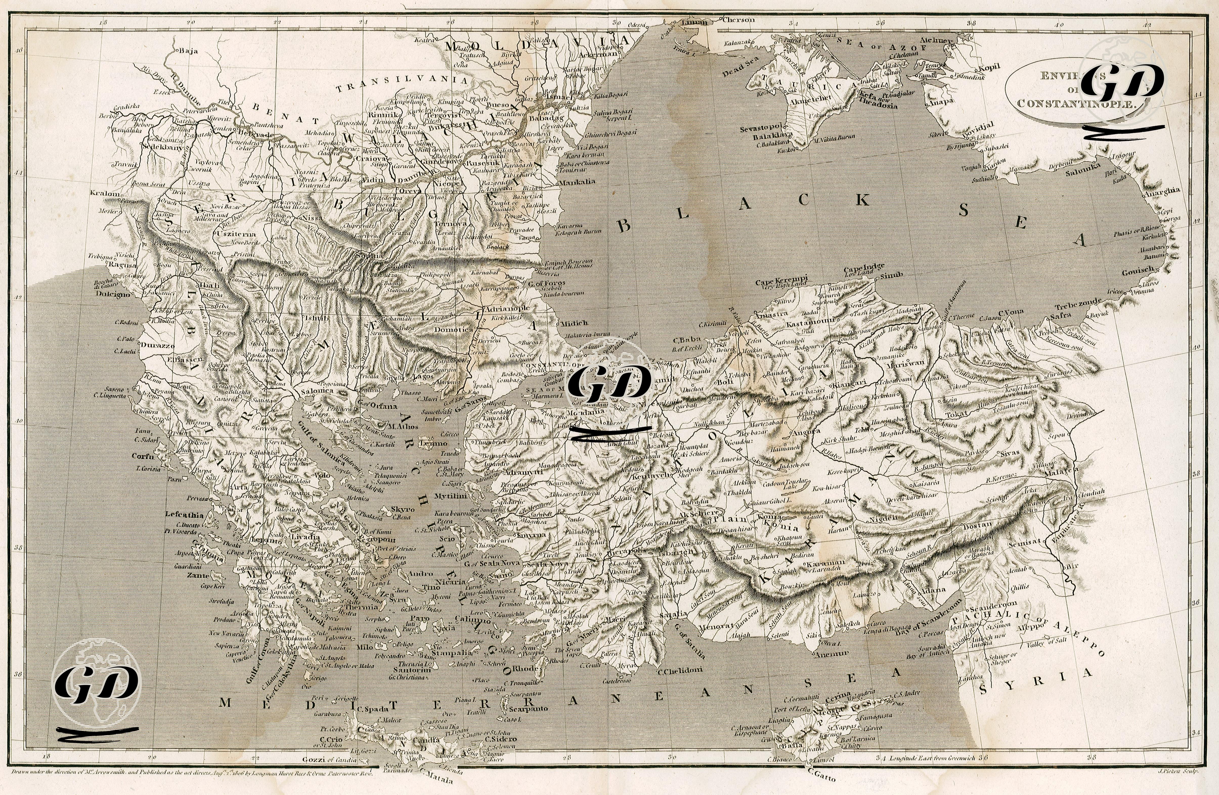
| Artist | Aaron Arrowsmith (1750-1823) |
| Engraver | J.Pickett |
| Date | 1806 |
| Technique | Copper Engraving |
| Category | Maps |
| Source | The Cyclopædia or Universal Dictionary of Arts, Sciences And literature, 1819, By Abraham Rees (Drawn Under The Direction Of Mr.Arrowsmith And Published As The Act Directs Aug.1 1806 By Longman Hurst Rees & Orme Paternoster Row.) |
This map, prepared at the beginning of the 9th century, is not limited to Istanbul, although its title states “Environs of Constantinople.” The map covers a very wide area, centered on the Bosphorus region, which served as a bridge between the European and Asian lands of the Ottoman Empire, including the Black Sea coast to the north, Kastamonu and Ankara to the east, Adana and Aleppo to the south, and the Greek mainland, Thessaly, Mora and the Aegean islands to the west. The mountain ranges on the map are given by the shading method (hachure), which creates a topographic perception.