GRAVÜR DÜNYASI
Digital Engraving Library
| Artist | John James Dower (1825-1901) |
| Engraver | John James Dower (1825-1901) |
| Date | 1860's |
| Technique | Steel Engraving |
| Category | Maps |
| Source | London, Published By Orr & Smith Amen Corner Paternoster Row |
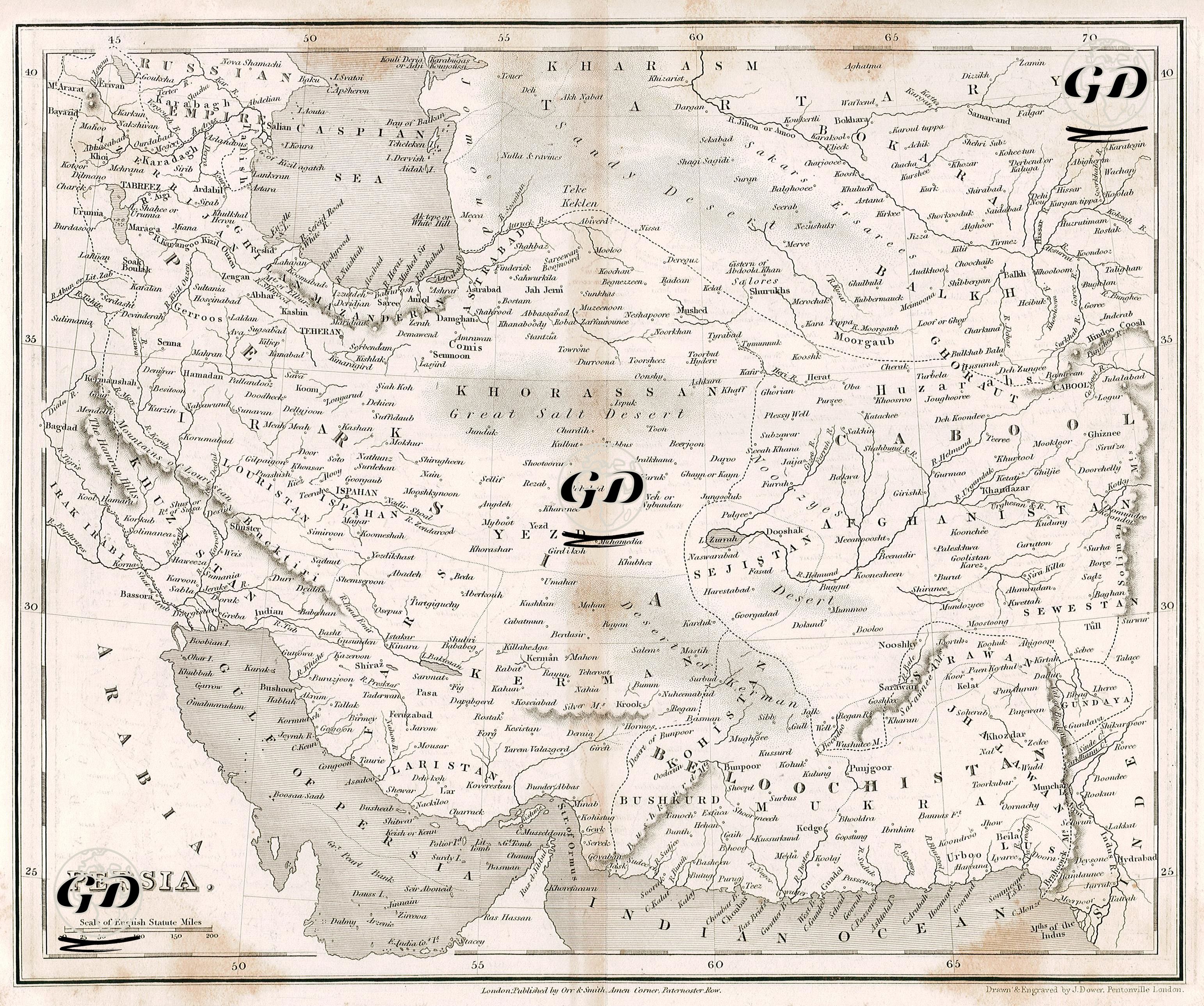
This map reflects the geography of Iran and the surrounding historical regions in detail. The map, which covers a large part of modern Iranian territory, also includes today's Turkmenistan, Uzbekistan, Afghanistan, Pakistan and the Persian Gulf coast. The names of the regions on the map, such as Khorassan, Sejestan, Laristan, Fars, Iraq Ajemi, Kerman and Boochistan, reveal the administrative and cultural geography of the period. The large region shown under the name "Khorassan" in the northeast covers today's Mashhad and its surroundings in Iran; it has been the center of science, literature and religious knowledge throughout history. "Kharasm" is located on the current Turkmenistan-Uzbekistan border and is an important cultural center adjacent to the Amu Darya River. In the east, the western and southern parts of Afghanistan are defined with cities such as "Herat", "Kandahar", "Gazna" and "Cabool" (Kabul) and are identified with the historical regions of Aria, Arachosia and Drangiana. In the south, ancient provinces such as "Laristan" and "Fars" occupy the shores of the Persian Gulf; these regions are the continuation of the ancient Persian lands. The map also points to the Gulf of Oman trade routes, along with important port cities such as “Bushehr”, “Bandar Abbas” and “Muscat”. The map was prepared to highlight strategic areas and trade routes that attracted the attention of British cartographers. The “Belloochistan” region, especially in the southeast, is a region that is historically semi-autonomous and located between Iran, Pakistan and Afghanistan. The large “salt desert” in the middle matches the current Kevir Desert.