GRAVÜR DÜNYASI
Digital Engraving Library
| Artist | Aaron Arrowsmith (1750-1823) |
| Date | 1828 |
| Technique | Copper Engraving-Original Hand Colored |
| Category | Maps |
| Source | Orbis Terrarum Veteribus Noti Descriptio. Comparative Atlas Of Ancient And Modern Geography, From Original Authorities, And Upon A New Plan For The Use Of Eton School |
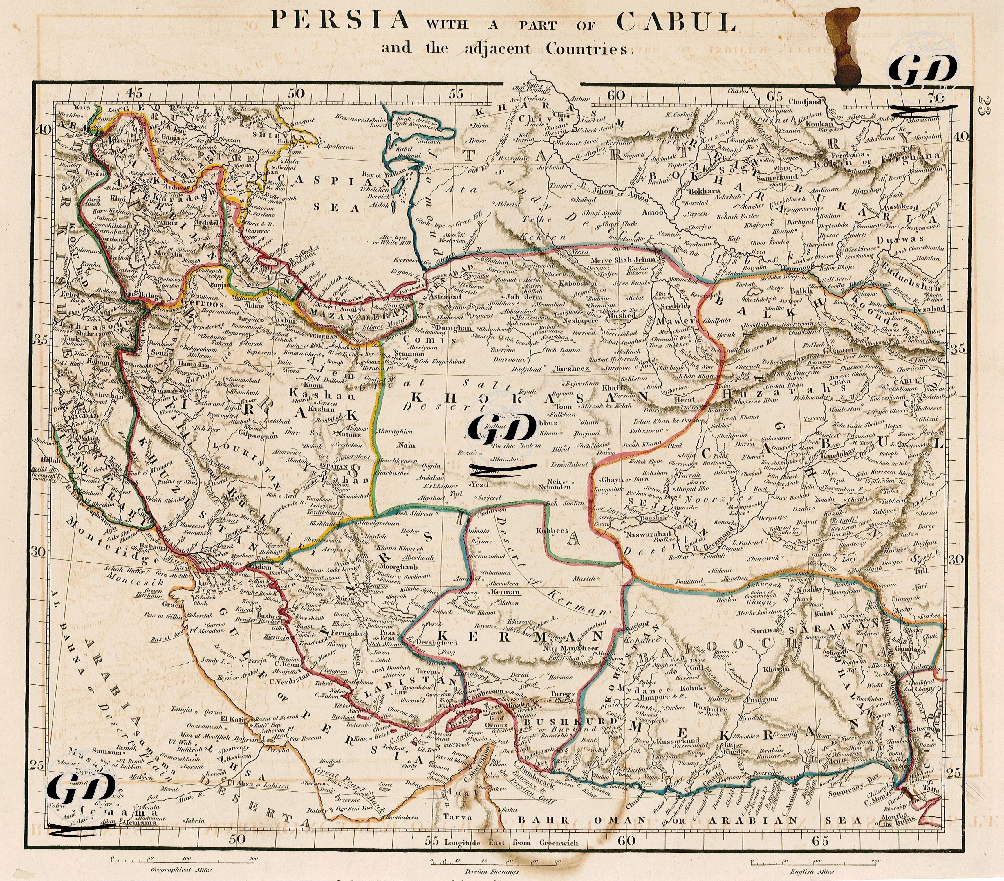
The map shows the geography of Iran (the Persian Empire of the period), the western and northern regions of today's Afghanistan (Cabul/Cabulistan), Baluchistan, the Caspian Sea, the Gulf of Oman and other important lands around it. The geographical regions on this map are presented in a demarcated and colored manner due to the influence of the Western-centered cartographic approach in the 19th century. The regions separated by colored border lines on the map reflect the administrative structure and major provinces of the period. The names of the regions such as "Khorasan", "Fars", "Kerman", "Azerbijan" in the center of the map are based on the classical Persian provincial system and important cities such as Shiraz, Isfahan, Mashhad, and Tabriz stand out. Similarly, cities within Afghanistan such as "Cabul", "Kunduz", "Herat", "Ghazni", and "Candahar" are also placed in a way that reflects the geopolitical relations of the period. While historical and geographical elements such as Balkh, Badakhshan and the Hindu Kush Mountains attract attention in the east of the map, the region drawing extending to the Iraqi borders in the west covers a wide hinterland that evokes the former glory of the Persian Empire. Strategic areas such as the Persian Gulf (Gulf of Persia), the Strait of Hormuz (Ormuz), and the Bahrain Islands are also clearly shown on the map, and sea connections are given importance. In this respect, the map allows for the analysis of not only land areas but also trade routes and ports. Topographic details - mountain ranges, desert areas, river lines - are meticulously processed with the engraving technique and reveal the physical geography of the region quite clearly. For example, the depiction of large desert areas such as the "Salt Desert" and the "Great Desert" reflects how travel and trade routes were shaped by natural obstacles at that time.