GRAVÜR DÜNYASI
Digital Engraving Library
| Date | 1870's |
| Technique | Steel Engraving |
| Category | Maps |
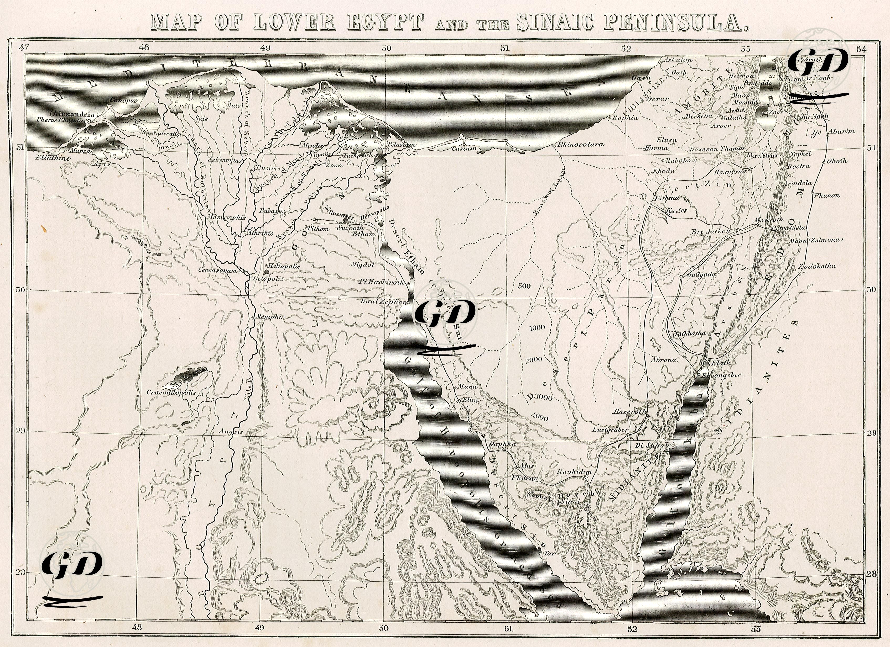
The map depicts a comprehensive area encompassing the northern Nile Delta (Lower Egypt), the Sinai Peninsula, the Red Sea coast, and the southern part of Palestine. In the northern part of the map, cities along the Mediterranean coast are clearly marked: Alexandria, Rosetta, Damietta, Port Said, and Gaza. Along the Nile Delta, ancient and modern settlement names such as Cairo, Heliopolis, Memphis, Migdol, Pelusium, and Heliopolis are prominent. The branching of the Nile River and its delta system are clearly depicted, providing a detailed depiction of the geography of Lower Egypt. In the southern part of the Sinai Peninsula, locations such as Jebel Serbal, Wady Feiran, Hazeroth, Elim, Wady Gharandel, Mount Sinai, Pharan, Wady Sheikh, and Ain Hudherah are listed, and points of biblical geography are identified. Names mentioned in sacred texts, such as Etham, Marah, Elath, Ezion Geber, Kadesh, Rephidim, Hazeroth, Taberah, Jotbathah, Mount Hor, Arabah, Zalmonah, and Punon, are located on the eastern side of the map, near the present-day border of Jordan and Israel, and offer insights into ancient migration routes. The map also highlights mountainous areas using shading representing the topographic relief with elevations (e.g., 500, 1,000, 2,000, and 3,000 feet); the mountain ranges of the Sinai Peninsula are particularly prominently modeled. The Gulf of Suez and the Gulf of Akabah are clearly named, and the peninsula between them clearly reveals the classic triangular geomorphology of Sinai. Mount Sinai, also known as Mount Moses, is indicated at the southern end of the map. On the eastern border, the River Jordan, the Dead Sea, the coastal cities of Palestine, and settlements such as Jericho, Jerusalem, Hebron, and Beersheba are marked.