GRAVÜR DÜNYASI
Digital Engraving Library
| Artist | Otto Delitsch (1821-1882) |
| Engraver | W.Isleib |
| Date | 1860's |
| Technique | Steel Engraving |
| Category | Maps |
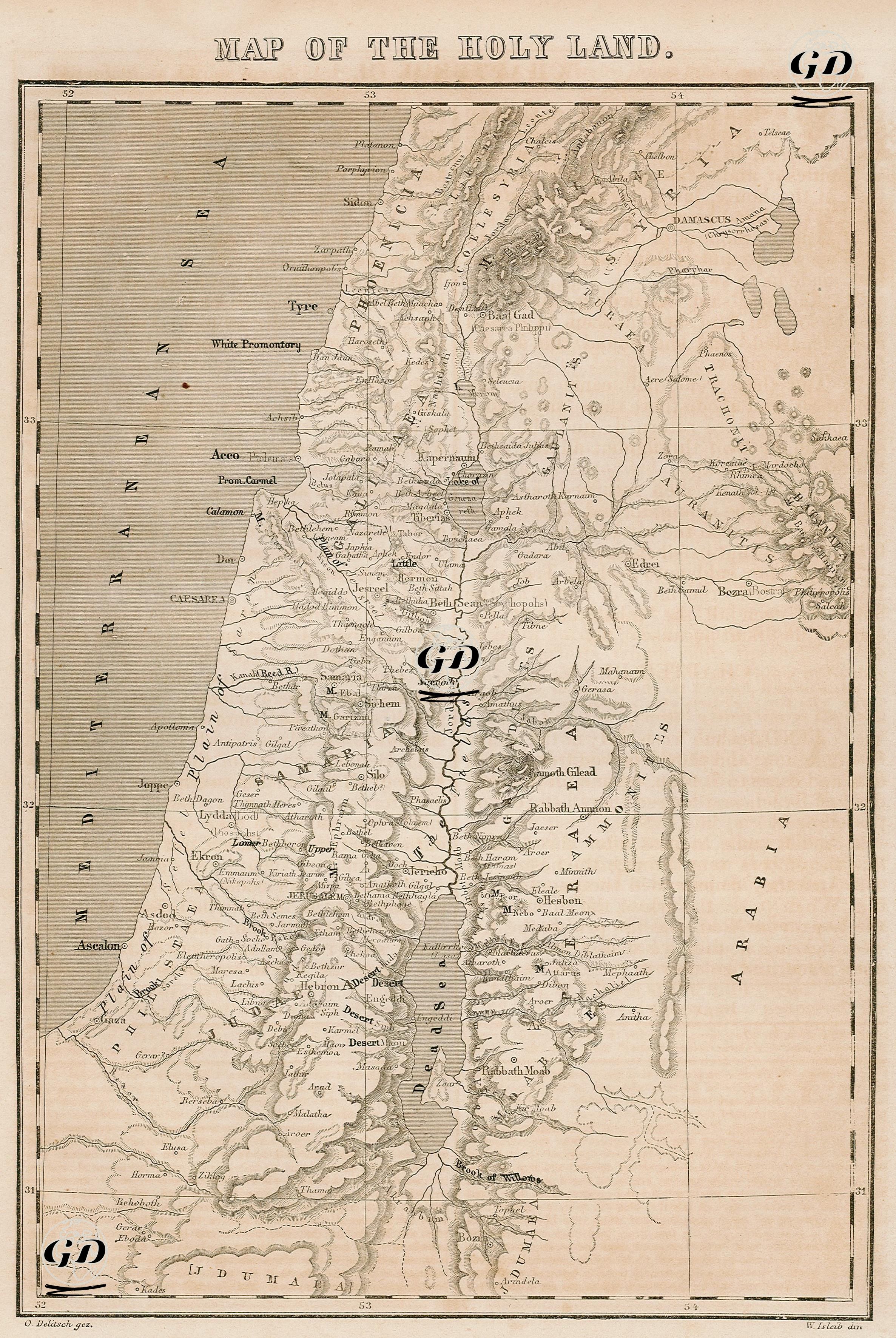
The map titled “Map of the Holy Land” is a typical 19th century map of sacred geography, designed to identify geographical locations mentioned in the Bible and to visually follow the locations where the Old and New Testament texts take place. The map covers a large part of the present-day lands of Israel, Palestine, Lebanon, Jordan and Syria. The Mediterranean is located in the west, and the desert belt called Arabia is located in the east; the Jordan River (River Jordan) passing through the middle and the Sea of Galilee and the Dead Sea that it feeds form the spatial backbone of the map. Many cities and regions mentioned in the sacred texts are shown in detail on this map. While centers such as Tyrus, Sidon, Zarephath, Dan, Capernaum, Bashan and Damascus are located in the north, there are cities frequently mentioned in the New and Old Testaments such as Nazareth, Nain, Samaria, Shiloh, Jerusalem, Bethlehem, Bethel, Jericho and Emmaus in the middle. In the south, the lands of Hebron, Gaza, Beersheba, Engedi, Zoar, Kadesh, Arad and Edom (Idumea) are shown. In the East Bank, the historical regions of ancient kingdoms such as Ammon, Moab and Gilead are marked. In this context, the map aims to document both the historical settlement traces of the Israelites and the topography of the Jewish-Christian narratives. When the typographic structure of the map is examined, cities and regions are depicted with different fonts, and mountains and elevations are expressed with the shading (hachure) method. In addition, large water sources and border lines aim to relate the distribution of settlements to natural obstacles.