GRAVÜR DÜNYASI
Digital Engraving Library
| Date | 1880's |
| Technique | Chromolithography |
| Category | Maps |
| Source | The Encyclopaedia Atlas - W.& A.K.Johnston Edinburgh And London |
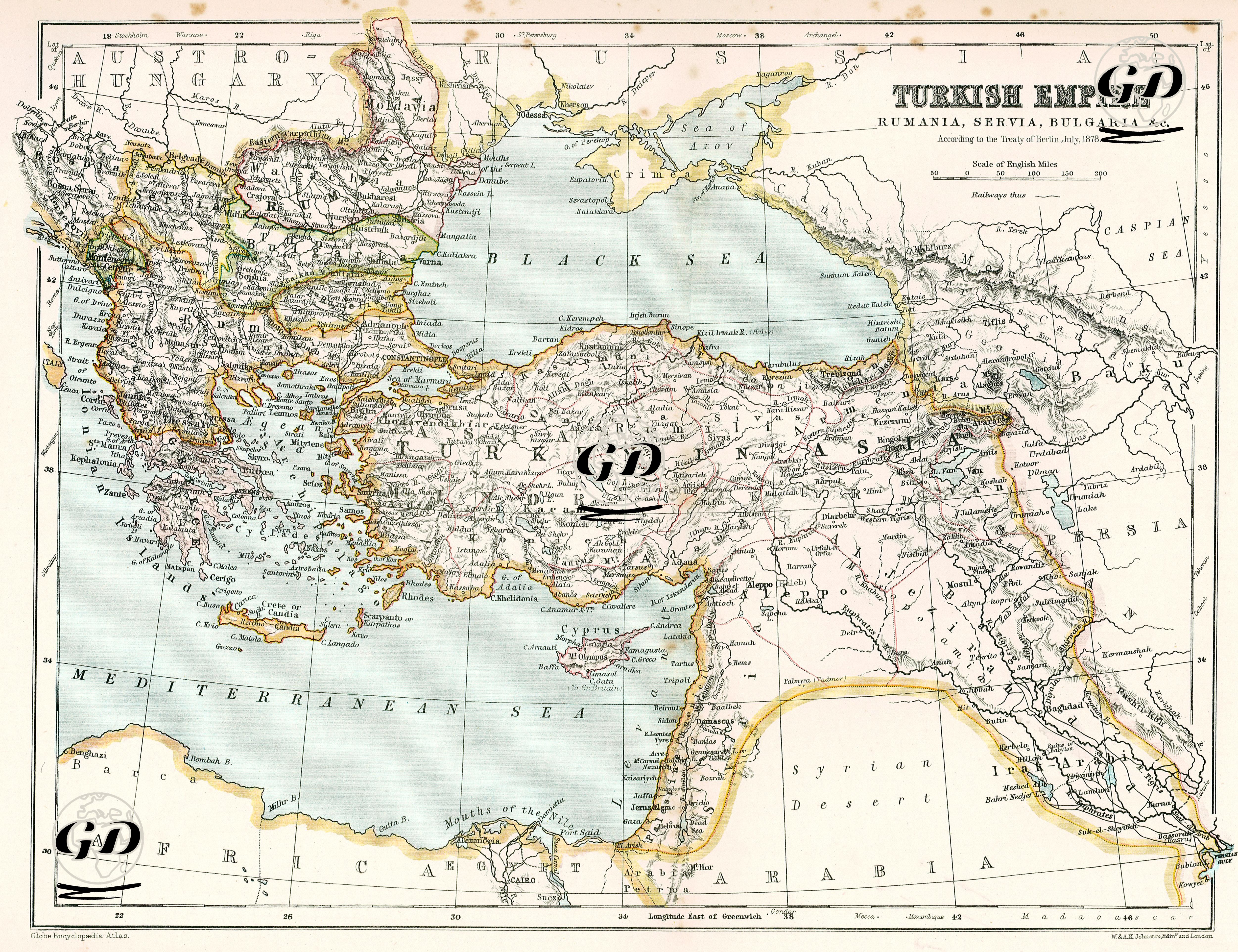
This map is an important political map showing the territories of the Ottoman Empire in Europe, Asia and Africa after the Berlin Treaty of July 13, 1878. The map reflects in detail the geopolitical disintegration of the Ottoman Empire in its later years, its diminishing European territory and its continuing presence in the east. The Berlin Treaty was signed after the 1877–1878 Ottoman-Russian War (93 War) and severely limited the Ottoman Empire's dominance in the Balkans. The map clearly shows the results of this treaty. Romania, Serbia and Montenegro gained independence, Bulgaria was separated as an autonomous principality and Bosnia-Herzegovina was occupied by Austria-Hungary (although it remained officially Ottoman territory, the administration changed hands). Ottoman rule in Anatolia, Mesopotamia, Syria, Palestine, Arabia, Egypt and North Africa continued, but British influence was increasing in Egypt, and this situation is also seen in the map with clues. The Ottoman territorial losses in the east (especially the surrender of Kars, Ardahan and Batum to Russia) are indicated by political borders on this map. Cyprus appears on the map as Ottoman territory, but was ceded to Britain in 1878 (de jure Ottoman territory, de facto British control). The map features coloured borders, clearly delineating political units. Province names are written in modern Latin script and English transcriptions. Mountains and elevations are shown using the classic cartographic shading technique.