GRAVÜR DÜNYASI
Digital Engraving Library
| Artist | Robert Sears (1810-1892) |
| Engraver | Robert Sears (1810-1892) |
| Date | 1835 |
| Technique | Copper Engraving |
| Category | Maps |
| Source | Published By T.Ward & Co.27 Paternoster Row May 1 1835 |
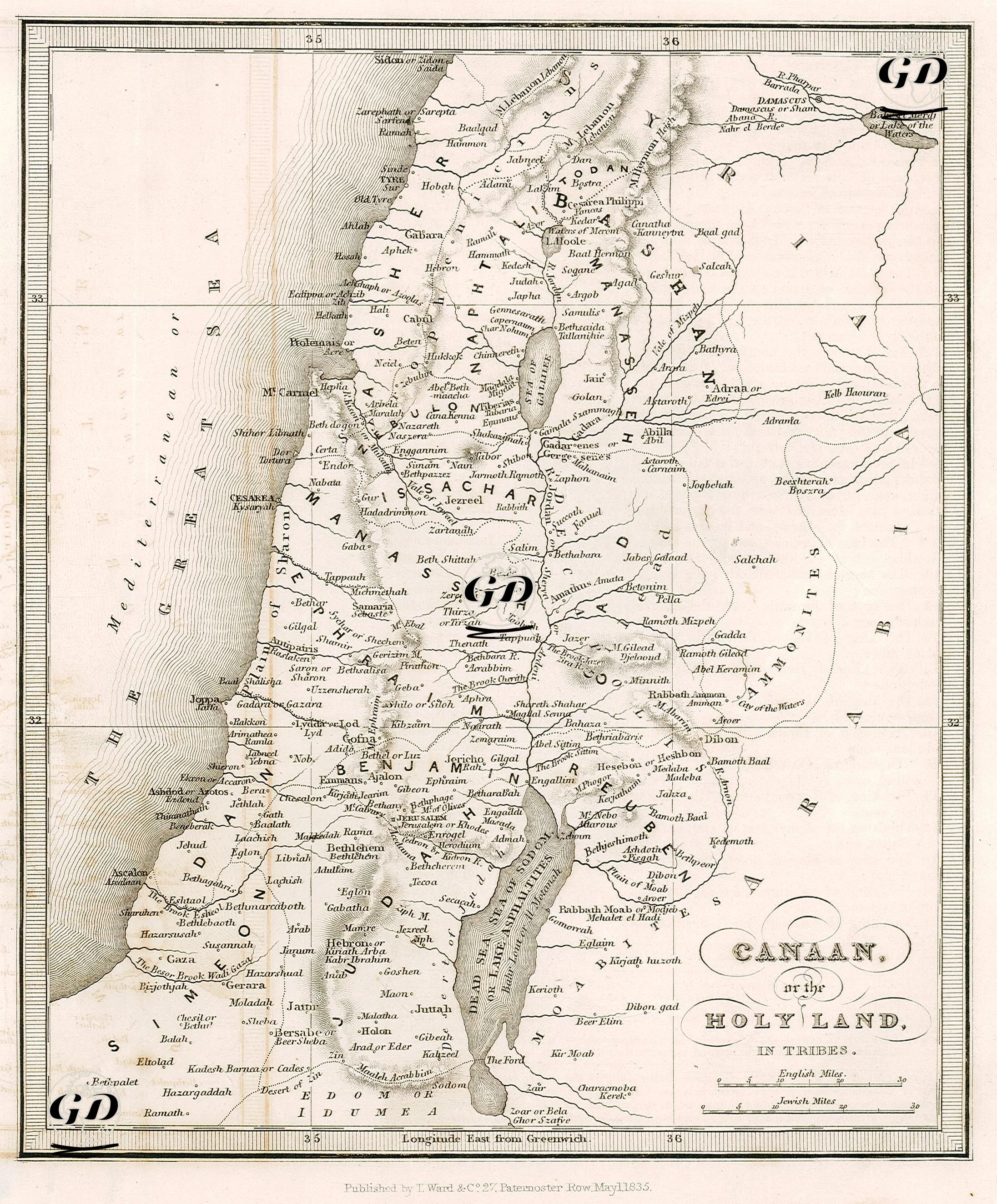
This map, dated 1835, shows in detail the settlements of the Twelve Tribes of Israel in the Old Testament texts in Canaan (the Holy Land). The map serves a theological as well as a geographical function, and provides a guiding system through the map for understanding and following the narratives of the sacred texts. The map extends from the Mediterranean coast to the east, namely the Jordan River, the Dead Sea, Moab, Ammon, Gilead and Bashan. In the north are Tirus (Tyre), Sidon, Laish and Dan, and in the south are settlements of both historical and religious importance such as Beersheba, Hebron, Gaza, Kadesh Barnea, Edom and Arabah. Topographically, mountains, valleys and rivers are shown with the classic 19th century shading (hachure) technique. One of the most striking aspects is the clear definition of tribal borders on the map. In this context; Judah and Simeon are in the south, Benjamin, Ephraim and Dan in the middle region, Issachar, Zebulun, Naphtali, Asher and Manasseh in the north and east. The tribes of East Manasseh, Gad and Reuben are located in the East Bank. This distribution is based on the geographical equivalents of tribal heritages mentioned in various sections of the Old Testament, especially in the Book of Joshua. The map indicates not only the borders of political settlements, but also the ancient Hebrew and English equivalents of the cities. Two different scales are given at the bottom: "English Miles" and "Jewish Miles", which shows that the map was prepared with a dual measurement system that appeals to both Western readers and Jewish tradition.