GRAVÜR DÜNYASI
Digital Engraving Library
| Date | 1870 |
| Technique | Steel Engraving |
| Category | Maps |
| Source | William Mackenzie Glasgow, Edinburgh & London |
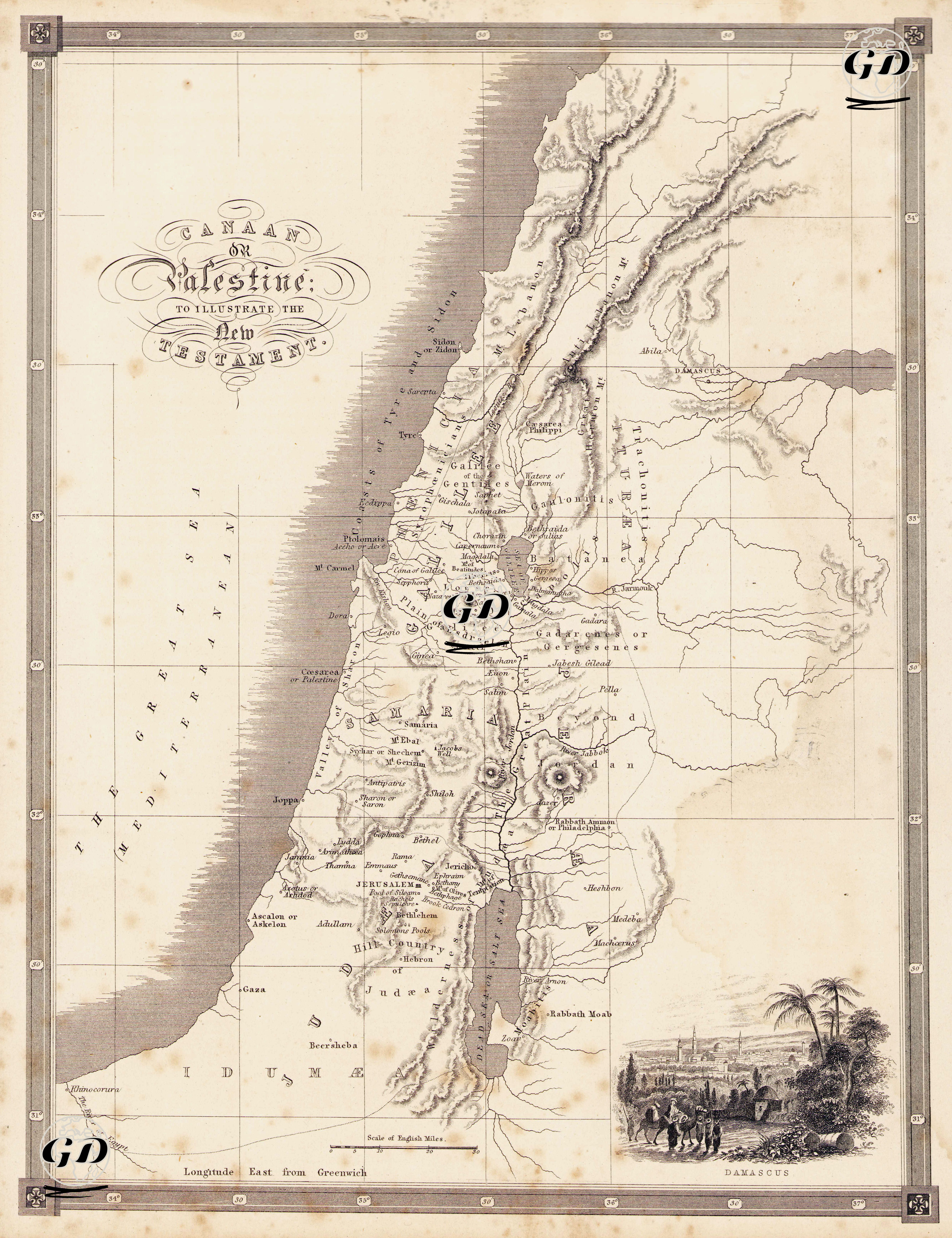
This map was published in the second half of the 19th century by William Mackenzie, based in Glasgow, Edinburgh and London, and was prepared to explain the topographical context of the New Testament. The title of the map includes the phrase "Canaan or Palestine"; this phrase reflects the dual meaning of this region in terms of both the Old Testament and the New Testament in historical and biblical contexts. The map aims to visually identify sacred places, particularly those related to the life, ministry, miracles and apostles of Jesus Christ, and to provide the reader with a geographical framework. The map covers parts of present-day Israel, Palestine, Lebanon, Jordan and Syria. The Mediterranean Sea is visible to the west, and the Jordan River, the Dead Sea and the Jordan Desert to the east. The Lebanon Mountains, Sidon, Tyrus and Baalbec are to the north, and Damascus to the east. In the south of the map, there are settlements in the Old and New Testaments such as Idumea (Edom) and Beersheba, Gaza, Ziklag, Hebron. One of the striking aspects of the map is the special emphasis given to the places where Jesus’ activities took place, such as Nazareth, Capernaum, Cana, Bethsaida, Magdala and Tiberias, located in the center. In addition, Jerusalem is positioned in the lower-center part of the map, and places where critical events in the context of the New Testament took place, such as Bethany, Bethlehem and Emmaus, are marked around it. In the small engraving illustration in the lower right corner, human figures in traditional clothing are depicted in the city of Damascus and its surroundings. This scene not only increases the aesthetic richness of the map, but also provides a visual idea of the cultural and historical texture of the region. The mountain ranges, rivers and elevations on the map are depicted with the shading technique (hachure), which was common in engraving cartography of the period. This technique provides topographic depth and spatial perspective. The map also includes locations connecting cities to each other in scale and is based on the English mile system.