GRAVÜR DÜNYASI
Digital Engraving Library
| Engraver | John Bartholomew (1805-1861) |
| Date | 1876 |
| Technique | Chromolithography |
| Category | Maps |
| Source | Blackie & Son, Glasgow, Edinburgh & London |
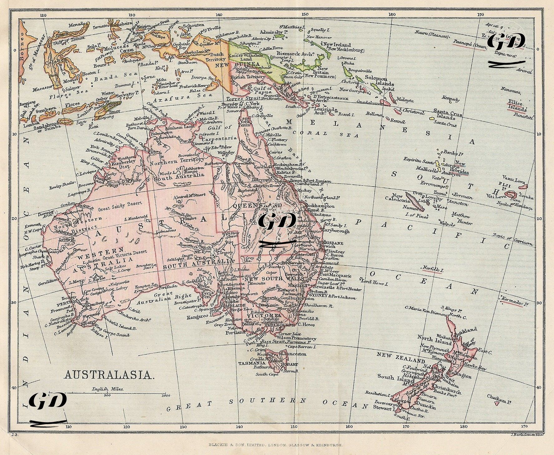
This 1876 color map, titled "Australasia," reflects Great Britain's colonial policies in the Pacific, the impact of geographical exploration, and its maritime strategies at the end of the 19th century. The map is not merely a geographical depiction; it is also a visual statement documenting the British Empire's political dominance over Australia, New Zealand, and surrounding islands. The map's title, "Australasia," was a broad regional designation used in British colonial discourse throughout the 19th century, encompassing both the Australian continent and parts of Oceania (especially Melanesia). The map reflects both the detailed inland delineation of the Australian mainland and the classification of Oceania's archipelagos. Australia is divided into six major colonial territories: Western Australia, South Australia, Queensland, New South Wales, Victoria, and Tasmania. Each territory is colored with its own borders, and its major cities, ports, and river systems are detailed. The removal of phrases such as "Unexplored Country," in particular, indicates that the Australian interior had been largely mapped and colonized by 1876. This highlights both the rapid expansion of European settlements and the social and ecological transformations faced by indigenous peoples (Aboriginal communities). To the east of the map, New Zealand, with its two main islands (North Island and South Island), is shown in detail. In addition to the geographical details, British coastal areas suitable for navigation, ports, and coral reefs are also carefully depicted. Named islands along the Pacific Ocean are divided into regions such as "Melanesia," "Fiji Islands," "Solomon Islands," "Gilbert Islands," "Ellice Islands," "New Hebrides," and "New Caledonia," as part of the ethnographic geography. These regions were also the sites of concentrated missionary activity, natural scientific expeditions, and commercial interests in the 19th century.