GRAVÜR DÜNYASI
Digital Engraving Library
| Date | 1859 |
| Technique | Steel Engraving-Original Hand Colored |
| Category | Maps |
| Source | The History Of England By Hume And Smollett (London, James S.Virtue) |
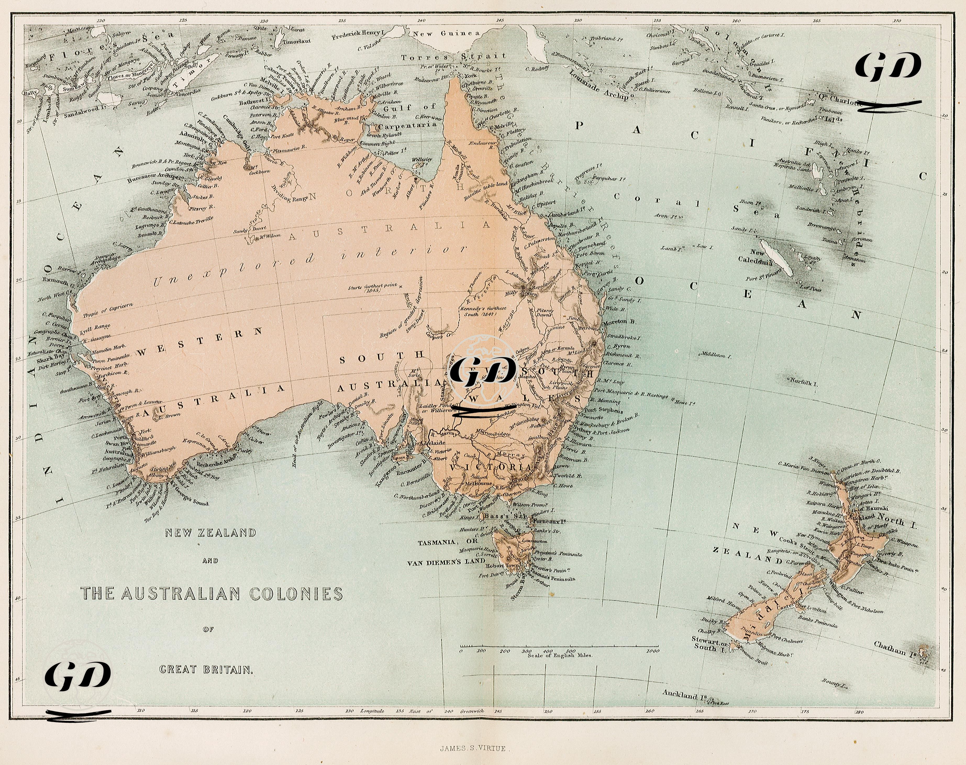
This 1859 map, titled "New Zealand and the Australian Colonies of Great Britain," covers the colonial geography of the British Empire in the mid-19th century. It comprehensively depicts the Australian continent, the New Zealand Islands, Tasmania (then known as Van Diemen's Land), and the islands of the Pacific that were either British possessions or under exploration. The map contains a significant detail reflecting the fact that the Australian continent had not yet been fully explored: the phrase "Unexplored Interior," which signifies the lack of knowledge of the interior of Western Australia, suggests that exploration activities of the period were limited to the coastline. This phrase documents both the European colonists' lack of knowledge of the interior and their lack of interest or access to Indigenous areas. The map also shows the six distinct Australian colonies—Western Australia, South Australia, New South Wales, Victoria, Queensland (a newly established colony), and Van Diemen's Land (Tasmania)—with their distinct boundaries. This regional division demonstrates that the British Empire adopted an administrative structure based on local administration rather than centralizing colonial rule. The map displays not only political boundaries but also detailed coastal morphology, island locations, and ocean currents. For example, the waterways and islands surrounding the Coral Sea and the Great Barrier Reef are meticulously marked, taking into account both maritime and geomorphological features. Important coastal features such as Bass Strait, Torres Strait, Spencer Gulf, Gulf of Carpentaria, and Port Phillip also stand out. The division of New Zealand into North Island and South Island highlights the coastal areas with dense settlements and ports. Furthermore, the location of Pacific islands such as the Chatham Islands, Norfolk Island, New Caledonia, the Fiji Group, and Lord Howe Island on the map demonstrates the broad reach of Britain's ocean strategy.