GRAVÜR DÜNYASI
Digital Engraving Library
| Artist | William Hughes (1818-1876) |
| Engraver | William Hughes (1818-1876) |
| Date | 1859 |
| Technique | Steel Engraving-Original Hand Colored |
| Category | Maps |
| Source | The History Of England By Hume And Smollett (London, James S.Virtue) |
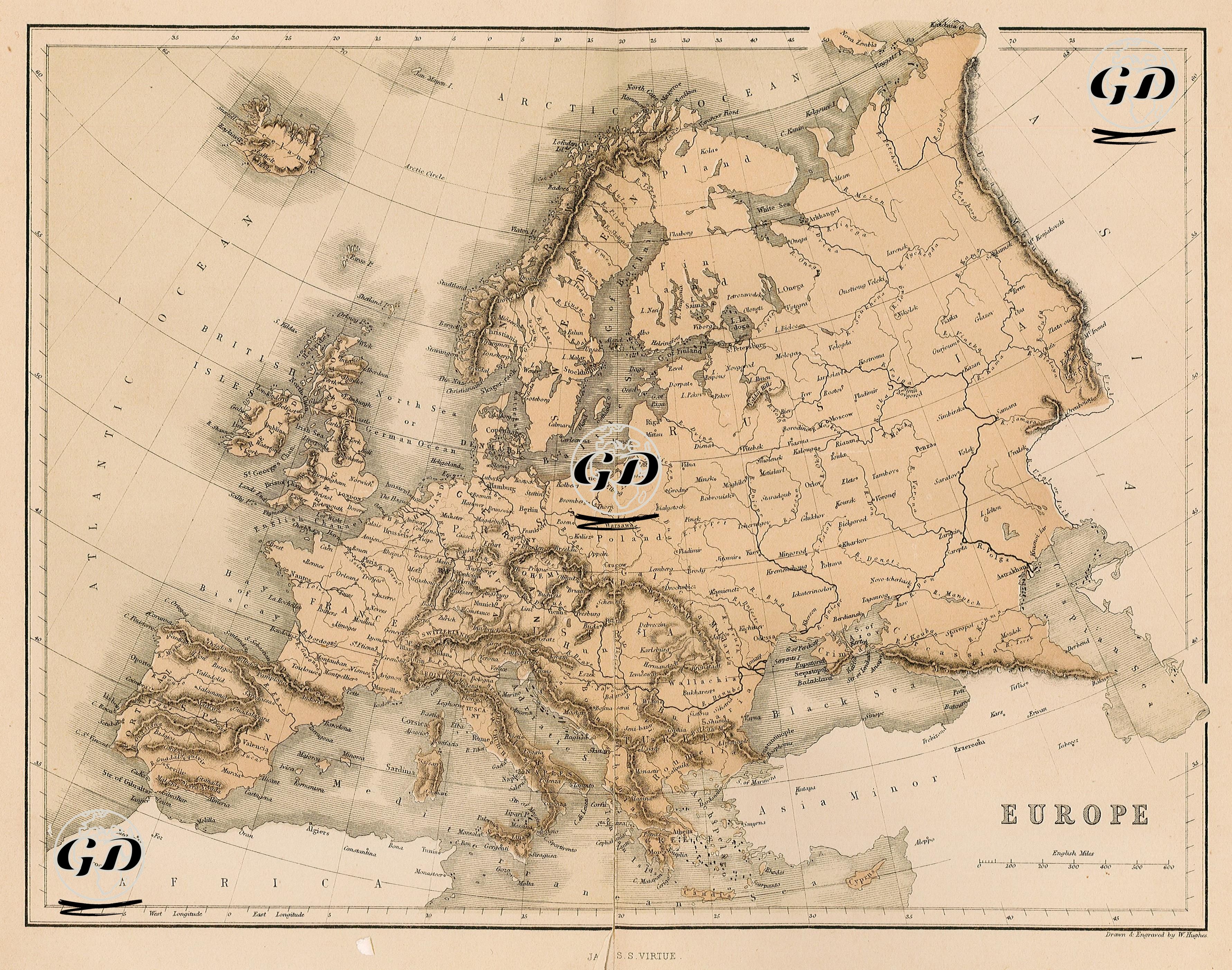
This map of Europe dated 1859 reflects the political and geographical perceptions of the time. Its engravings and contours are meticulously crafted, providing a comprehensive documentation of mid-19th-century Europe in terms of both geopolitical and natural elements. One of the map's most striking features is the divergence of the political boundaries and state structures of the period from those of today. For example, Germany, not yet unified, consisted of numerous small states, duchies, and kingdoms. Units such as Prussia, Saxony, and Bavaria were independent or autonomous. Similarly, Italy, not yet unified, was divided into regional powers such as the Papal States, the Two Sicilies, and Tuscany. In northwestern Europe, England, Scotland, the island of Ireland, and the surrounding archipelago are grouped under the heading "British Isles"; Iceland, directly to the northwest, is extensively detailed. In the northeast, the Scandinavian countries of Norway and Sweden, as well as Finland, are clearly delineated. During this period, Finland held the status of a Grand Duchy of the Russian Empire. In Eastern Europe, the vast territories of the Russian Empire extending westward are striking. Cities such as Moscow, Kiev, and Odessa are depicted on the map, and Russian influence is clearly felt along the northern shores of the Black Sea. In Southeastern Europe, the Ottoman Empire still holds sway in the Balkans. Regions such as Bulgaria, Serbia, Bosnia, and Albania were within Ottoman borders. Anatolia was designated as "Asia Minor." Western European countries such as France, Spain, and Portugal are quite close to modern borders and are presented with detailed city markings. In terms of physical geography, mountain systems such as the Alps, Pyrenees, Carpathians, and Scandinavian mountain ranges are shaded in engravings, and major rivers (Rhine, Danube, Volga) are shown in detail. Similarly, coastal inlets, islands, and straits are meticulously mapped.