GRAVÜR DÜNYASI
Digital Engraving Library
| Date | 1880's |
| Technique | Chromolithography |
| Category | Maps |
| Source | The National Encyclopaedia: A Dictionary of Universal Knowledge (Published by William Mackenzie, London) |
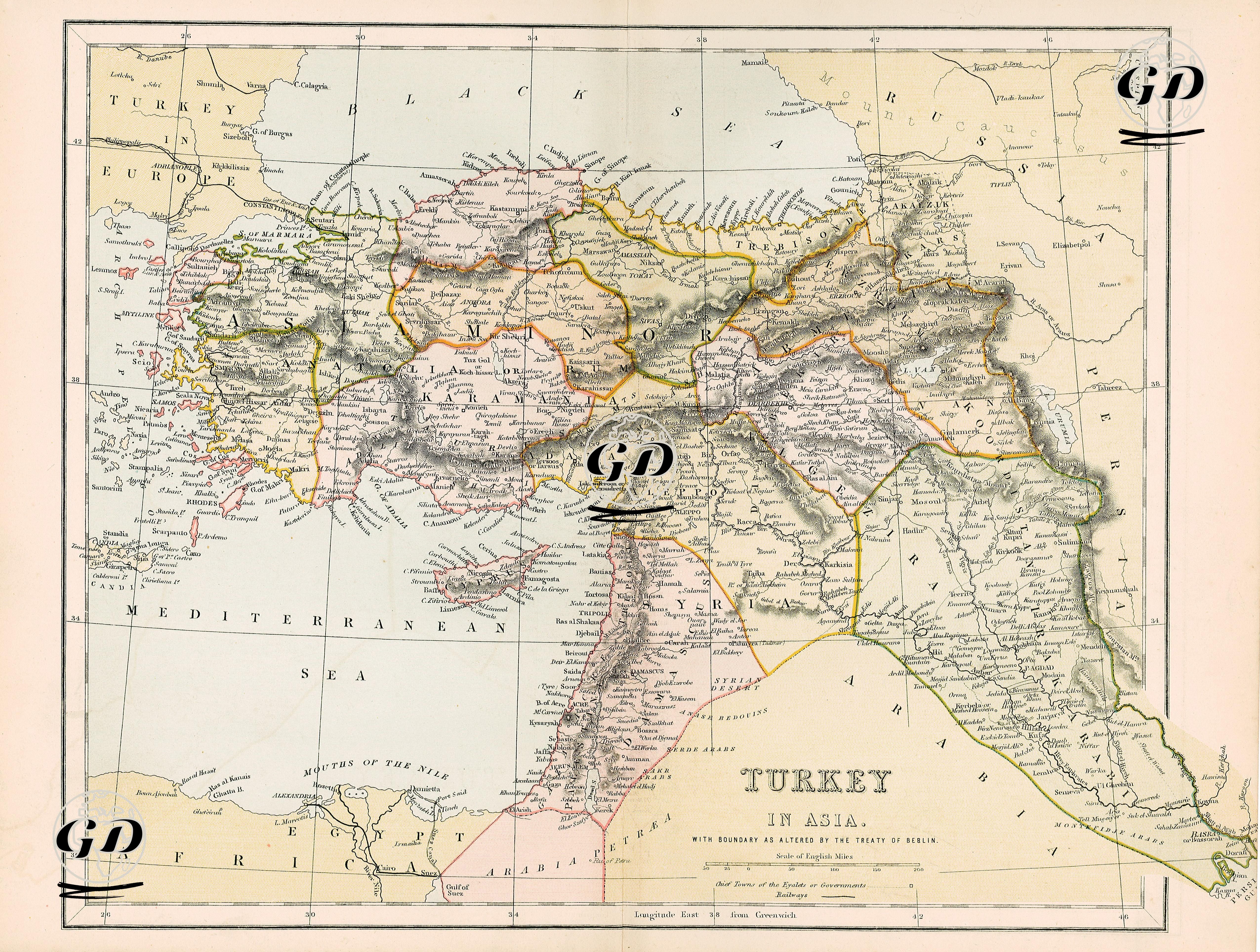
This map is a classic British-sourced political map from the last quarter of the 19th century, showing the Ottoman Empire’s lands in Asia (Anatolia, Mesopotamia, Syria, and the north of Arabia) in detail. The striking title on the map is “Turkey in Asia.” This is a reflection of the tradition of European cartographers dividing the Ottoman Empire into two geographical regions, “Turkey in Europe” and “Turkey in Asia.” The map is based on the new borders formed after the 1878 Berlin Treaty. In this context, the Ottoman territorial losses in the east (especially Kars, Ardahan, and Batum being given to Russia) are indicated on this map with political borders. On the map, the Anatolian Peninsula (Asia Minor) is divided according to the province system. The province names are given in their Anglicized forms (e.g. Konia, Angora, Sivas). The regions of Diyarbakır, Van, and Bitlis are marked as “Kurdistan” on the map. This is an example of the ethnogeographical region designations common in 19th-century Western cartography. Mesopotamia (with ancient names such as Babylonia and Chaldaea), covering the region up to the Persian Gulf, was shown as the provinces of Baghdad and Basra, while the desert areas in the south were designated as the "Arabian Desert". They were marked as separate administrative units as the provinces of Beirut, Damascus, Aleppo and Jerusalem. The detailed settlement names, especially in the Palestinian region, are striking. In addition, mountain and river systems were presented with shading and river route tracing techniques in accordance with the cartographic standards of the period.