GRAVÜR DÜNYASI
Digital Engraving Library
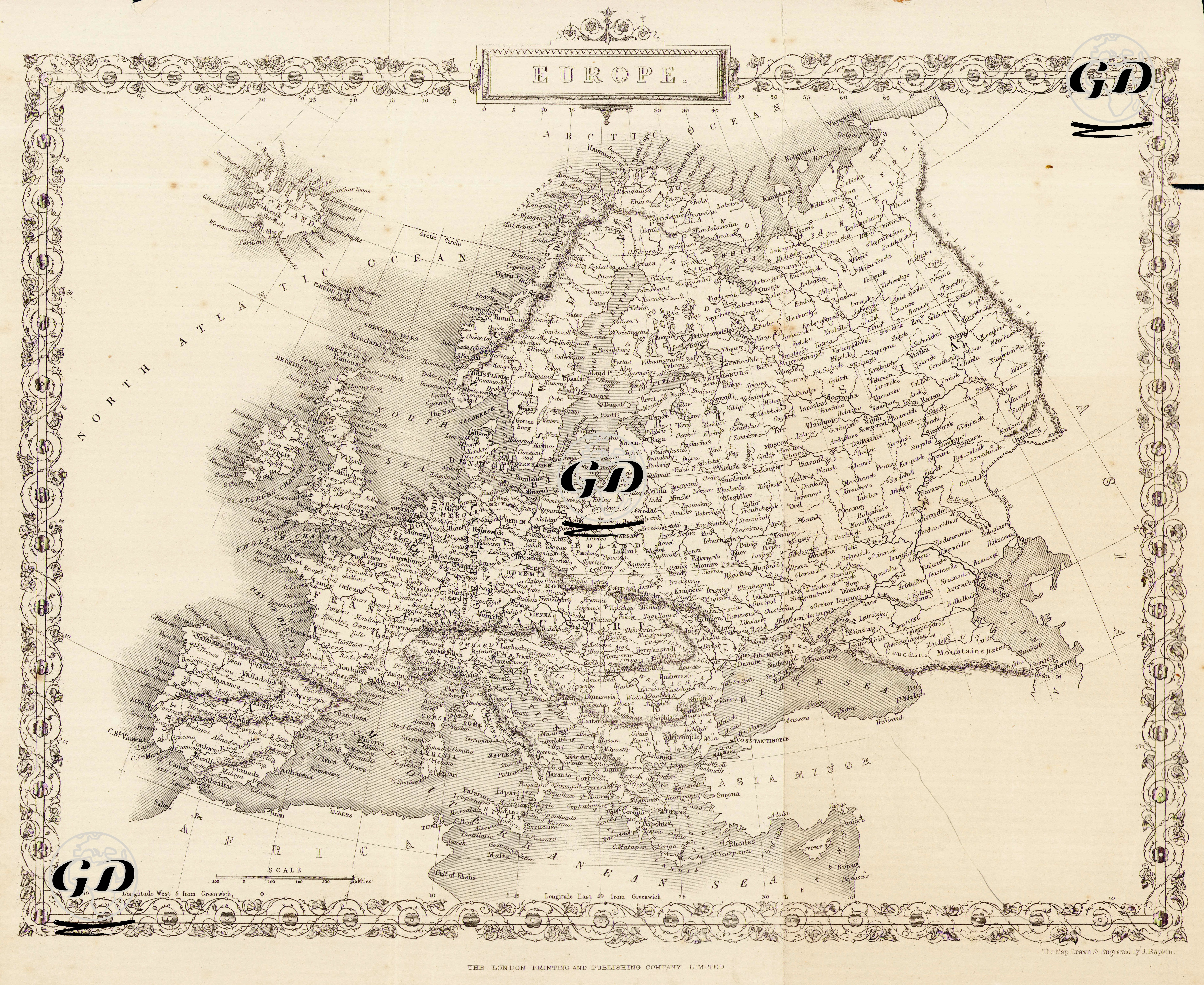
| Artist | John Rapkin(1815-1876) |
| Engraver | John Rapkin (1815-1876) |
| Date | 1860 |
| Technique | Steel Engraving |
| Category | Maps |
| Source | The London Printing And Publishing Company Limited |
This map dated 1860 details the European continent geographically, politically, and culturally, while also incorporating Ottoman territories (Asia Minor) to the southeastern edge of the map. Its border ornamentation, typography, and geographical content, in keeping with the map concept of the time, encompass a vast area from the Atlantic Ocean and the coast of Ireland in the west to the Ural Mountains and the Caspian Sea of the Russian Empire in the east. To the south lie the Mediterranean, the coast of North Africa, and the border of Asia, while to the north, details extend from the farthest reaches of Norway to the Arctic Ocean. English toponyms (names of cities, countries, and seas) on the map are written in accordance with the terminology of the period. For example, "Turkey in Europe" refers to the Ottoman territories in the Balkans, while "Asia Minor" represents the Anatolian geography. Italy is shown as yet unified, while Germany is a multitude of small states and principalities. England and Ireland are drawn in detail, with coastal cities, rivers, and sea routes meticulously marked. Geographical elements such as the Scottish Highlands, the Norwegian fjords, the Baltic Sea, and the Danish Straits add depth to the map not only from a political perspective but also from a natural perspective. Furthermore, Iceland is located in the upper left corner of the map, indicating its extension into the sub-polar regions. In the Balkan Peninsula, Ottoman-held territories such as Croatia, Serbia, Bulgaria, and Bosnia are marked with their internal borders, and river systems (e.g., the Danube River) are shown in detail. Major Ottoman cities can be discerned on the Anatolian Peninsula.