GRAVÜR DÜNYASI
Digital Engraving Library
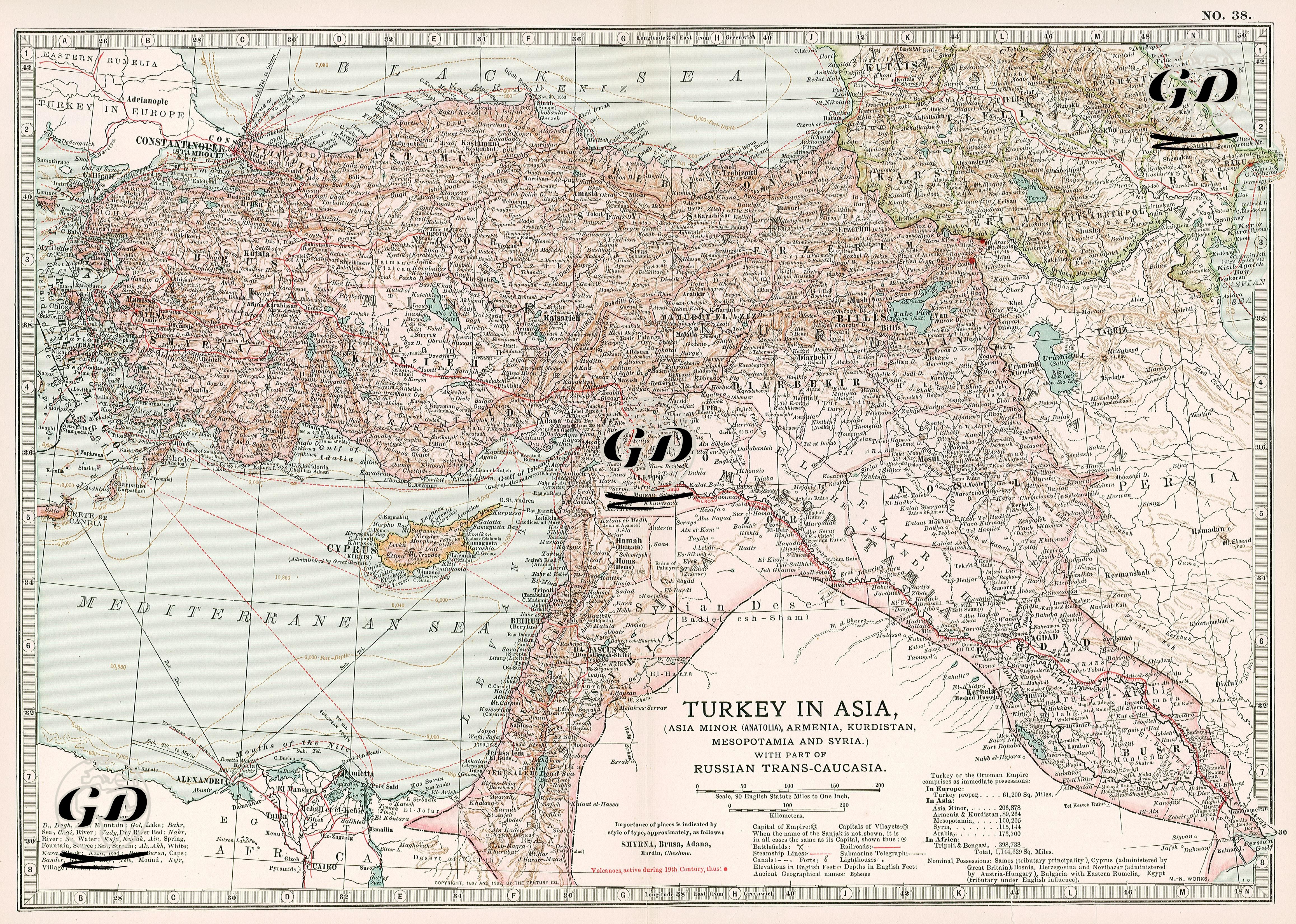
| Date | 1903 |
| Technique | Chromolithography |
| Category | Maps |
This colorful and detailed map provides a comprehensive overview of the provinces of the Ottoman Empire in Asia and the regional definitions used in Europe for these lands as of the beginning of the 20th century. The title specifically mentions the regions of Anatolia (Asia Minor), Armenia (Armenia), Kurdistan (Kurdistan), Mesopotamia (Mesopotamia) and Syria (Syria). These are not actual administrative regions on the map, but represent ethno-geographical understandings. The map also includes some of the regions under Russian rule in the Caucasus. The Ottoman provinces on the map are shown with different colors and detailed borders. Provincial centers and important cities are written in large font (Smyrna, Brusa, Konieh, Angora, Sivas, Trebizond, Erzeroum, Diarbekir, Mosul, Baghdad, Aleppo, Damascus, Jerusalem, etc.) Topographic details (mountains, rivers) are drawn very precisely (mountain ranges such as Taurus, Anti-Taurus, Amanus, Zagros and rivers such as Euphrates, Tigris, Jordan are included. Places such as Kars, Ardahan, Batum, and Tbilisi in the Caucasus region are shown as Russian territory. These areas had passed from the Ottoman Empire to Russia with the 1878 Berlin Treaty.