GRAVÜR DÜNYASI
Digital Engraving Library
| Date | 1890's |
| Technique | Steel Engraving-Original Hand Colored |
| Category | Maps |
| Source | Longmans, Green & Co. London, New York & Bombay |
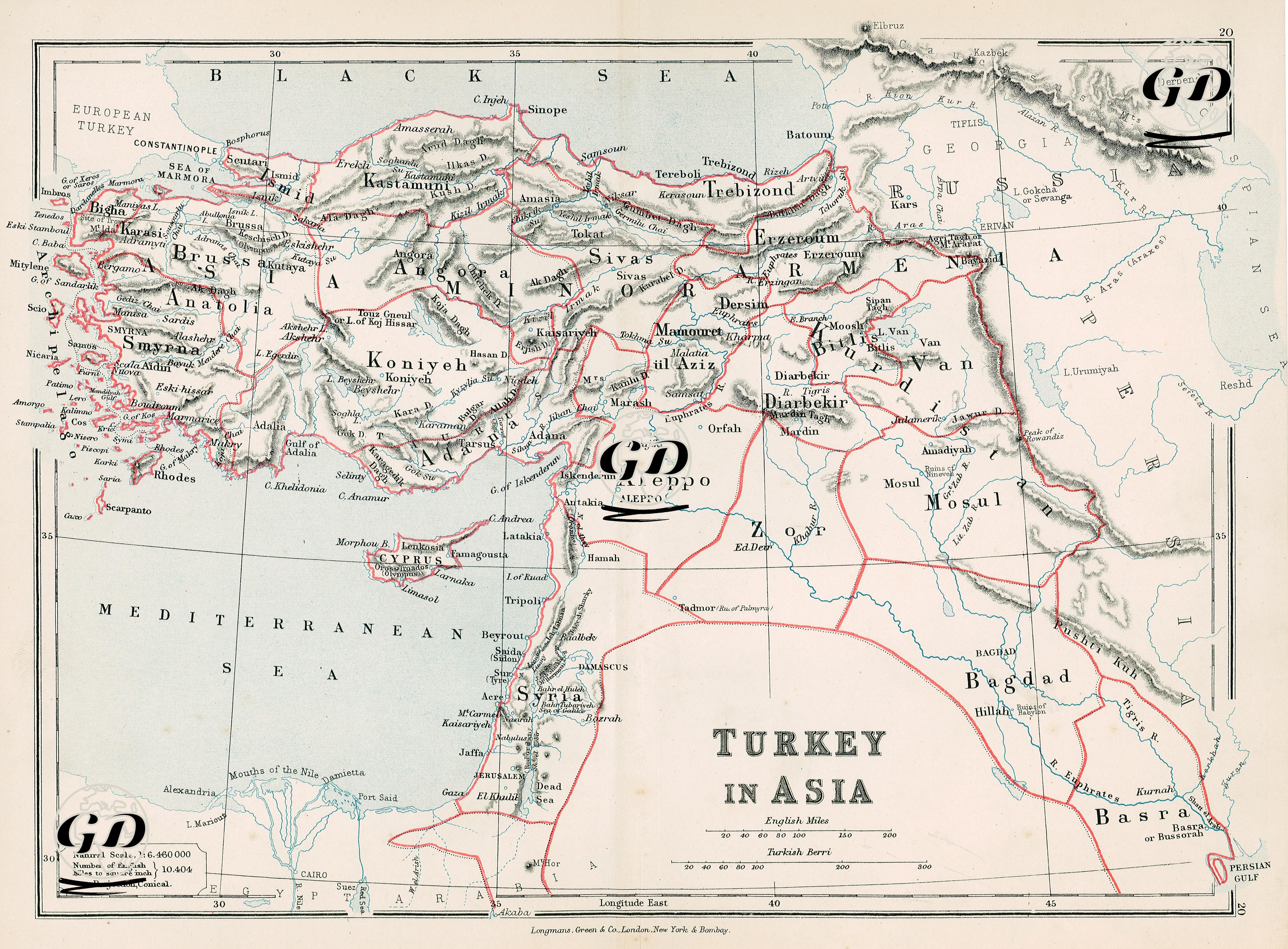
This map was prepared in the second half of the 19th century and is an engraving with an English title, which describes in detail the lands of the Ottoman Empire in Asia, namely Anatolia, Mesopotamia, Syria, Palestine, the north of Arabia and the eastern part of Egypt. The title includes the phrase "Turkey in Asia", which is a classic usage in European literature indicating that the Ottoman lands were geographically divided into two (Europe & Asia). The map distinguishes mountainous regions with colored border drawings and shading technique. Important cities such as Istanbul, Izmir, Aleppo, Baghdad and Mosul are clearly marked. In addition, river systems, mountain chains and road connections are detailed.