GRAVÜR DÜNYASI
Digital Engraving Library
| Date | 1855 |
| Technique | Copper Engraving-Original Hand Colored |
| Category | Maps |
| Source | Published By J.H.Colton & Co. No.172 William St. New York |
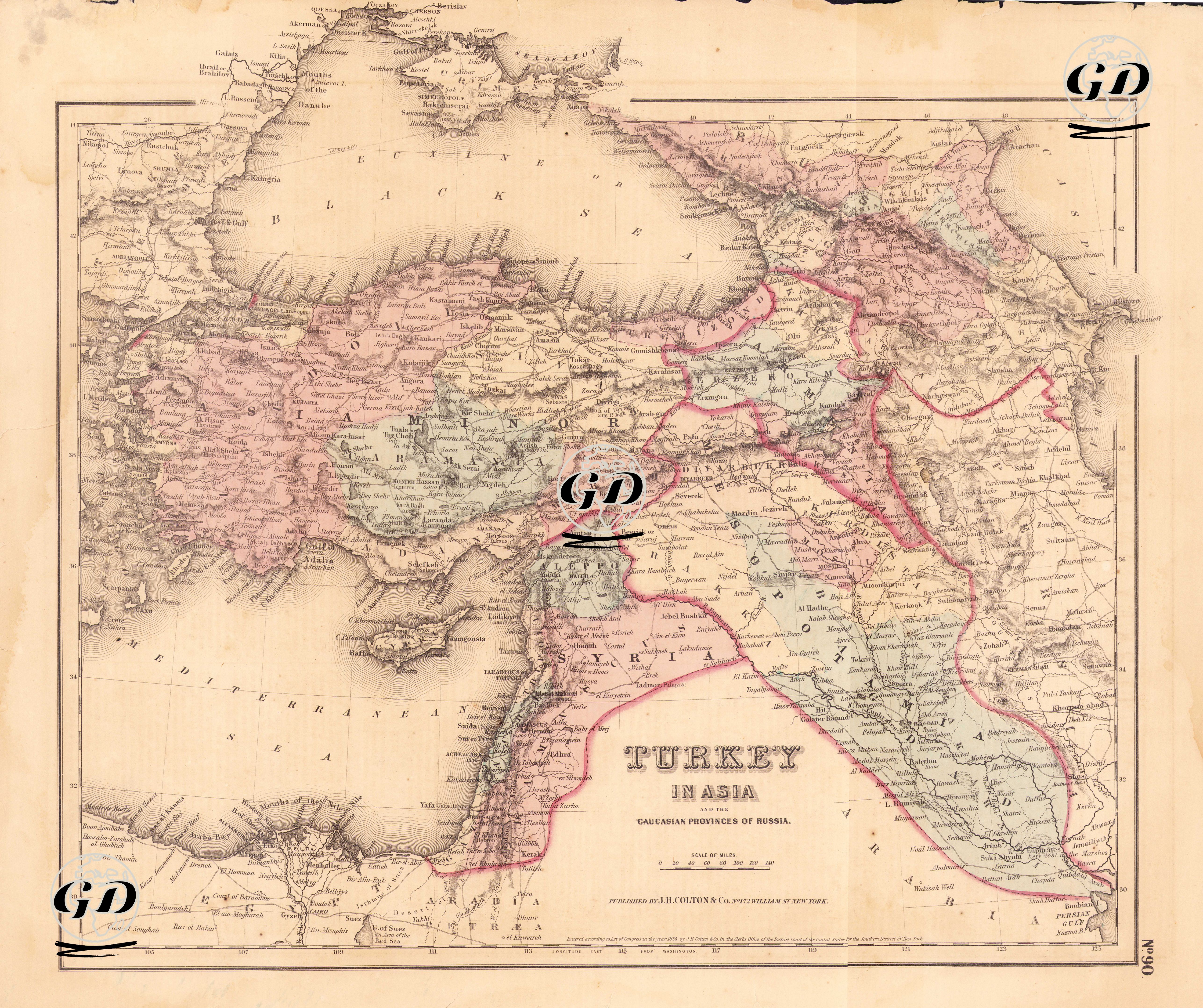
This map was published in New York in 1855 and is considered one of the most detailed Ottoman maps of American origin. The map shows in detail the provinces of the Ottoman Empire in Asia as well as the Caucasus provinces of Russia. The title includes the phrase “Turkey in Asia”, which is a classic usage in Western literature that shows that the Ottoman lands are geographically divided into two (Europe & Asia). The map includes the entire Anatolian Peninsula and distinguishes between the provinces with colored border drawings. The regions of Mesopotamia, Syria and Palestine are shown in detail (centers such as Baghdad, Basra, Mosul, Damascus, Aleppo and Jerusalem stand out). The north of Arabia and the Hejaz region are also included on the map to a limited extent. Cyprus and the northeast of Egypt (Nile Delta) are shown in the southwest of the map. In the Caucasus, cities such as Tbilisi, Yerevan and Baku are defined as the Caucasus provinces of Russia. The map is hand-coloured in accordance with the Colton printing techniques of the period, with borders marked with pastel tones. The topography is given in classical shading (hachure). The names of cities, towns, rivers and mountains are detailed. Although not fully compliant with the Ottoman province system, they are drawn based on regional integrity and major urban centers.