GRAVÜR DÜNYASI
Digital Engraving Library
| Engraver | J.& J.Neele |
| Date | 1827 |
| Technique | Copper Engraving |
| Category | Maps |
| Source | London, Published May 1 1827 By J.Mawman & The Other Prorietors |
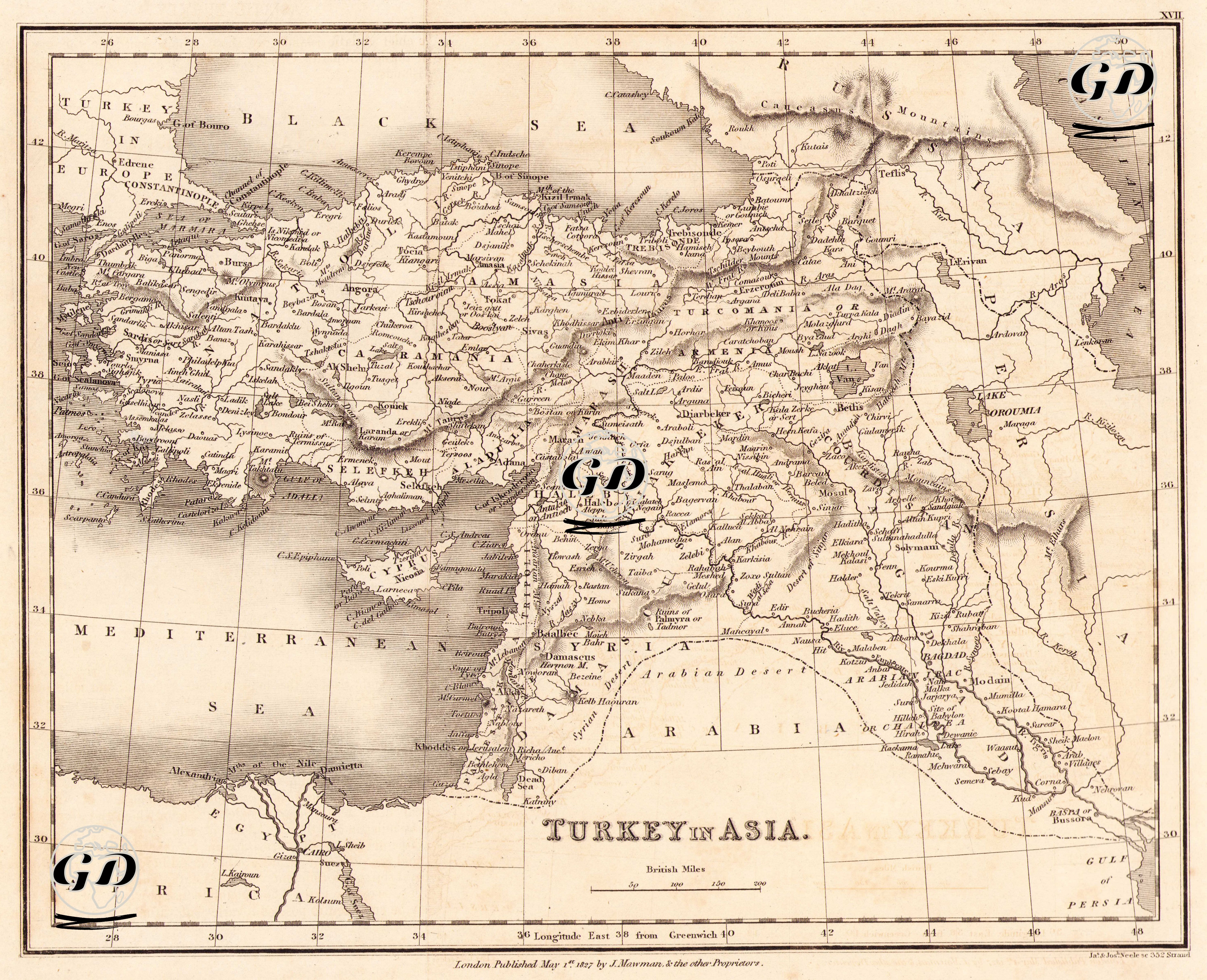
This map was published in London on May 1, 1827 and comprehensively presents the Asian lands of the Ottoman Empire (Anatolia, Mesopotamia, Syria, Palestine, Hejaz and the eastern part of Egypt). The title includes the phrase "Turkey in Asia", which is a classic usage in European literature that shows that the Ottoman lands were geographically divided into two (Europe & Asia). The map is an engraving that emphasizes regional, urban and topographic details rather than political borders. Geographically, natural structures such as the Black Sea, the Mediterranean, the Persian Gulf, the Euphrates and Tigris rivers, and the Taurus and Zagros mountains are depicted in detail. The distribution of city names and the roads highlighted on the map clearly reveal the trade routes, strategic urban centers and port points of the period. Important Ottoman cities such as Istanbul, Aleppo, Mosul, Damascus, Baghdad and Basra are in central locations. The map, printed with the copper printing technique, successfully conveys topographic details with the shading method. The drawing style on the map and the relief representation of the mountain ranges reflect the aesthetic and technical qualities of 19th-century Western cartography.