GRAVÜR DÜNYASI
Digital Engraving Library
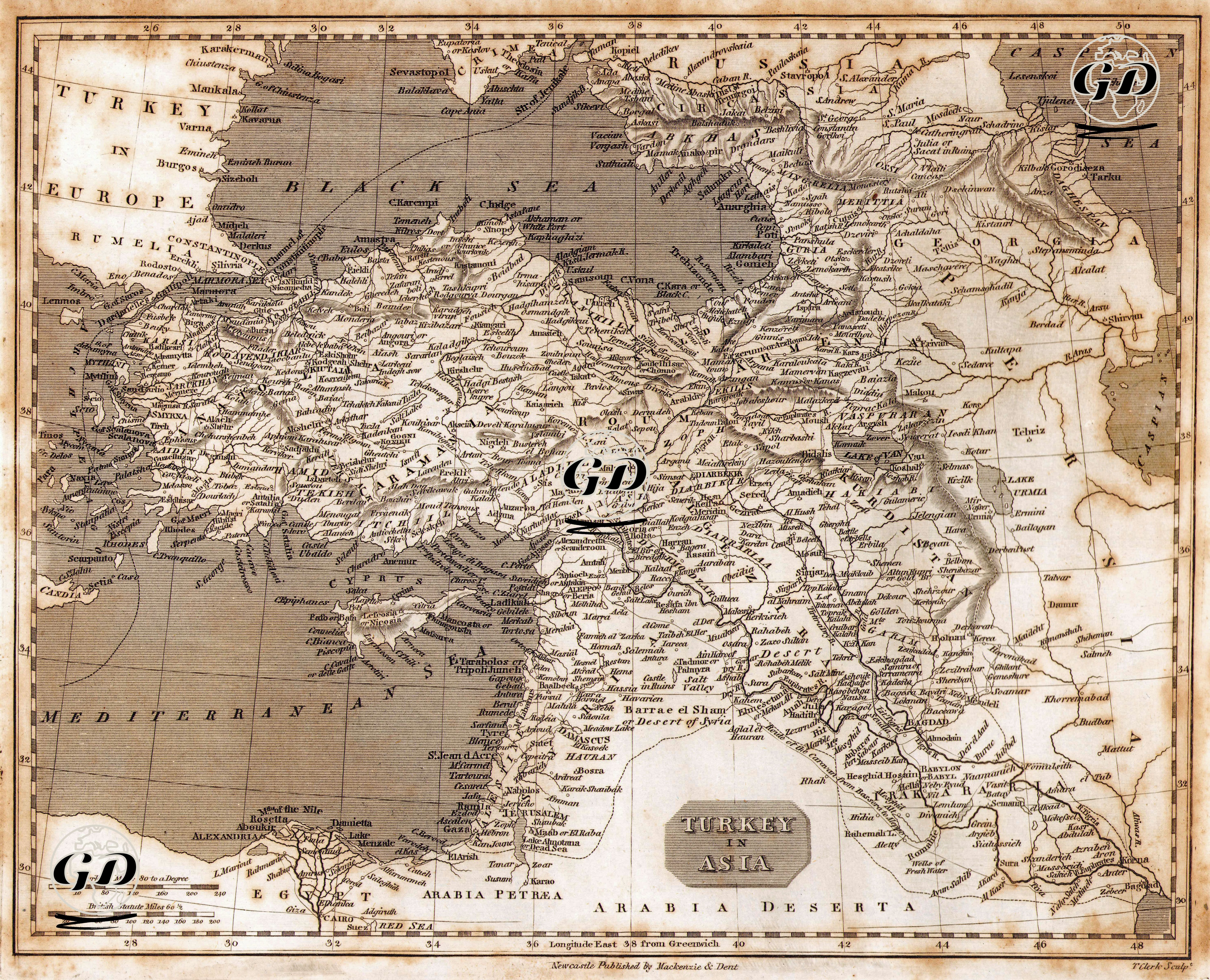
| Engraver | T.Clerk |
| Date | 1820's |
| Technique | Copper Engraving |
| Category | Maps |
| Source | Newcastle Published By Mackenzie & Dent |
This map was prepared in the first half of the 19th century and is an engraving with an English title, which describes in detail the lands of the Ottoman Empire in Asia, namely Anatolia, Mesopotamia, Syria, Palestine, the north of Arabia and the east of Egypt. The title includes the phrase "Turkey in Asia", which is a classical usage in European literature indicating that the Ottoman lands were geographically divided into two (Europe & Asia). Printed with copper printing technique, the map shows mountain ranges and elevations in detail with the shading method (hachure). River systems are meticulously depicted (Euphrates, Tigris, Orontes rivers are particularly noteworthy). Cyprus, the north of Egypt, the Sinai Peninsula, the interior of Arabia and the Hejaz region are included. The wide area from Alexandria to Mosul, from Damascus to Baghdad is shown under the title "Turkey in Asia".