GRAVÜR DÜNYASI
Digital Engraving Library
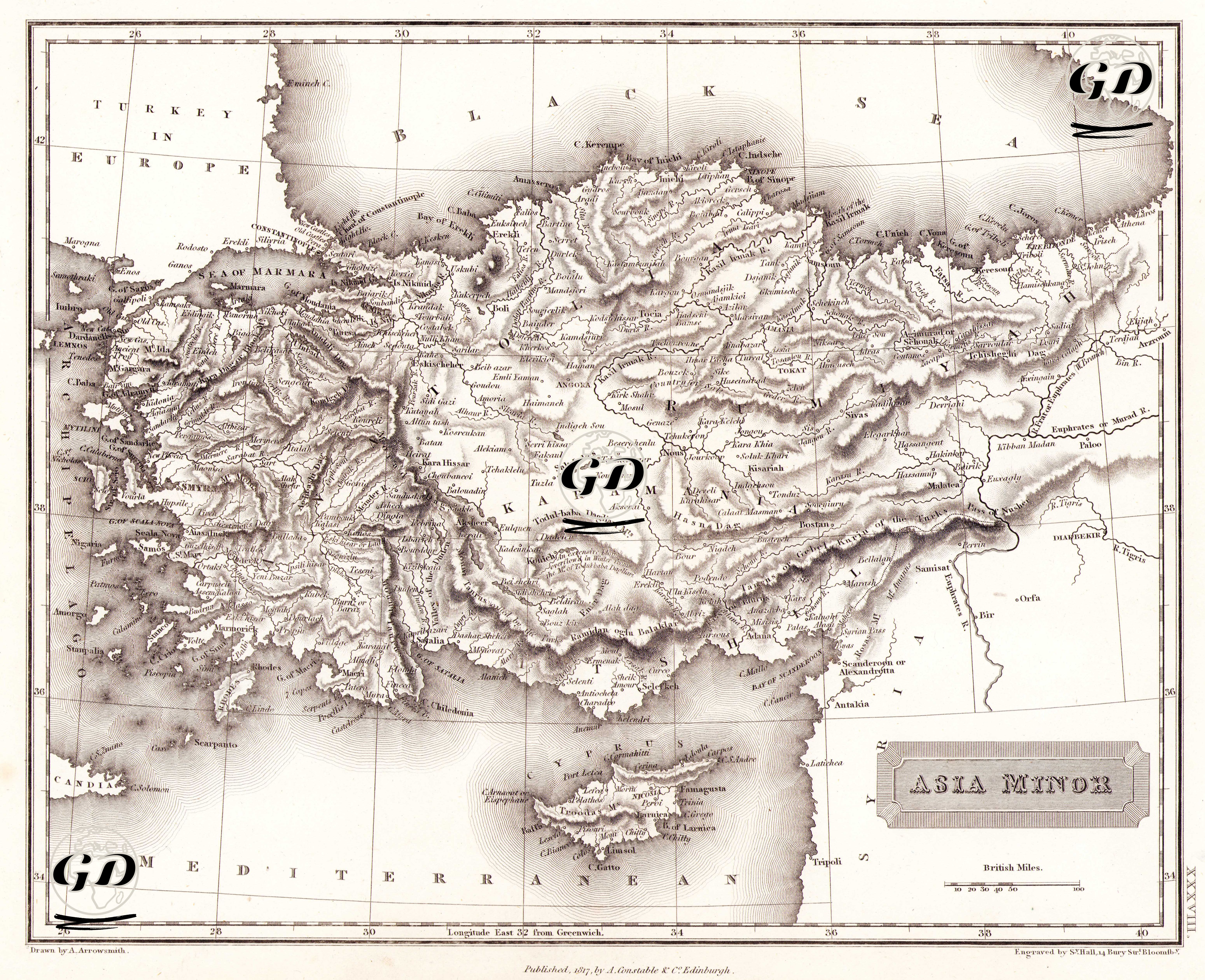
| Artist | Aaron Arrowsmith (1750-1823) |
| Engraver | Sidney Hall (1788-1831) |
| Date | 1817 |
| Technique | Copper Engraving |
| Category | Maps |
| Source | A New General Atlas (Published, 1817 By A.Constable & Co.Edinburgh) |
This map was published in 1817 by A. Constable & Co. in Edinburgh and presented under the title "Asia Minor". While the map reflects the historical-geographical details of the region that today constitutes the Anatolian peninsula of Turkey, it was shaped according to the classical geography understanding of Western European scientists of the period. The most striking feature of the map is that it shows Anatolia not only in terms of Ottoman provinces but also in the context of ancient cities, valleys and mountain ranges. For example: Ancient regions such as Troad, Mysia, Lydia, Caria, Pamphylia, Cilicia are included in their English forms. Similarly, cities such as Ephesus (Efes), Sardis (Sart), Iconium (Konya), Tarsus, Antioch (Antakya) are marked due to their historical and geographical importance. Mountainous areas are shown with the shading method, i.e. "hachure", a cartographic technique of the period; this visually emphasizes the height and topography. Especially mountain ranges such as Taurus (Toros), Amanus (Nur Mountains), Antitaurus are clearly drawn. Political borders are not shown on the map. This shows that it is not a modern map but rather a cartographic study that synthesizes ancient and 19th century geography. At the same time, the map is longitudinal according to the Greenwich Meridian, which shows that it was prepared according to the scientific standards of British cartography. The maps of Asia Minor are also directly related to the efforts of British, French and German orientalists to revive ancient texts.