GRAVÜR DÜNYASI
Digital Engraving Library
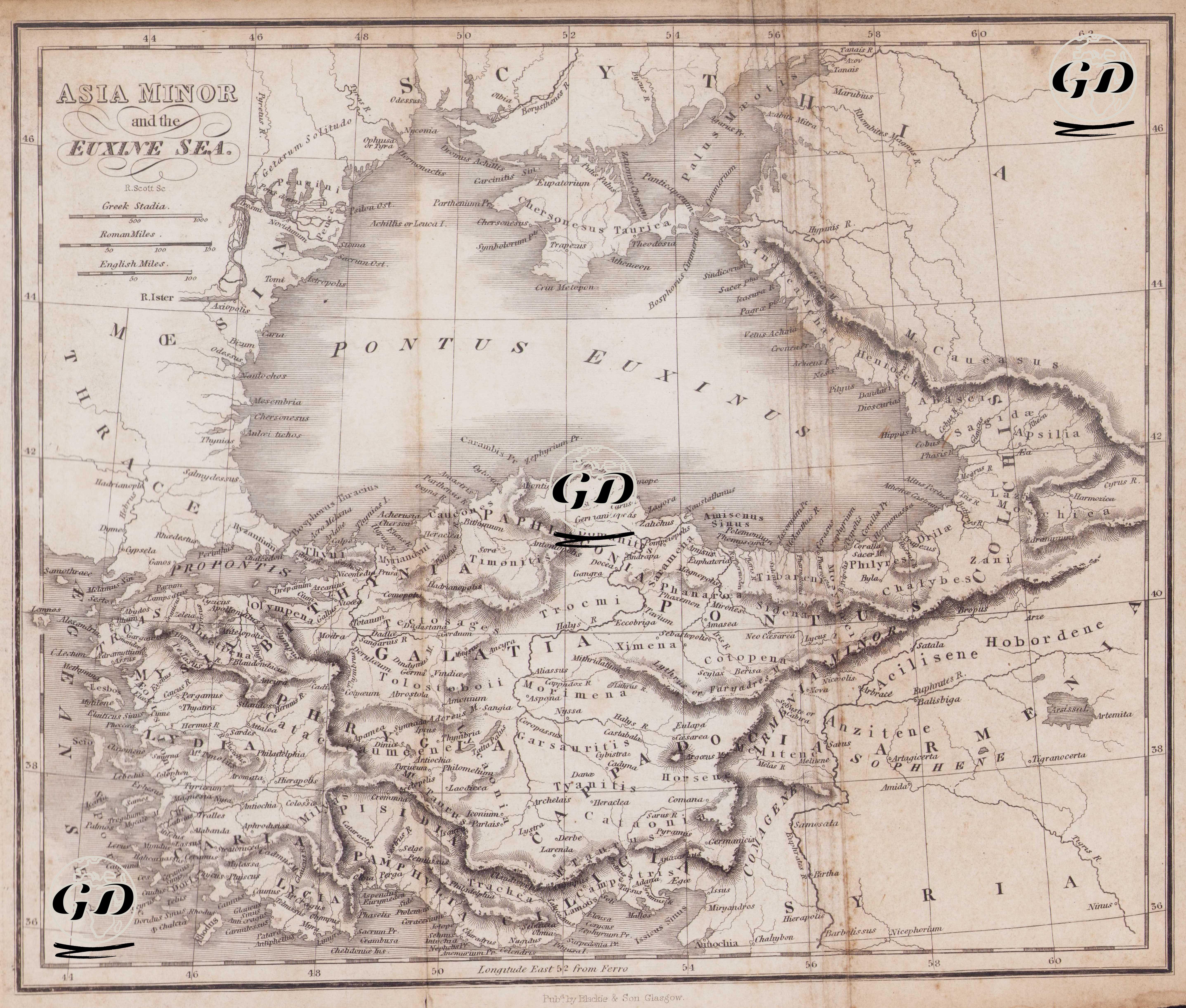
| Engraver | Robert Scott (1777-1841) |
| Date | 1826 |
| Technique | Copper engraving |
| Category | Maps |
| Source | The Ancient History of The Egyptians, Carthaginians, Assyrians, Babylonians, Medes and Persians, Grecians, and Macedonians - Published by Blackie & Son, Glasgow |
This 1826 map, titled “Asia Minor and the Euxine Sea,” is a copperplate print centered on Anatolia (Asia Minor), encompassing the Pontus Euxine-Black Sea basin and its surroundings, reflecting the scientific and educational atlas aesthetic of the early 19th century. The map extensively depicts coastlines, river networks, and settlement and ancient center names. Ancient Latin regional names such as Bithynia, Galatia, Cappadocia, Pontus, and Paphlagonia are particularly prominent. Landforms are rendered using the hachure technique, a standard practice of the time, to create a relief effect. The scale lines include Greek Stadia, Roman Miles, and English Miles, allowing for reading the map using different historical measurement systems. The inscription “Longitude East 52 from Ferro” at the bottom indicates that the map's longitude reference is based on the Ferro meridian.