GRAVÜR DÜNYASI
Digital Engraving Library
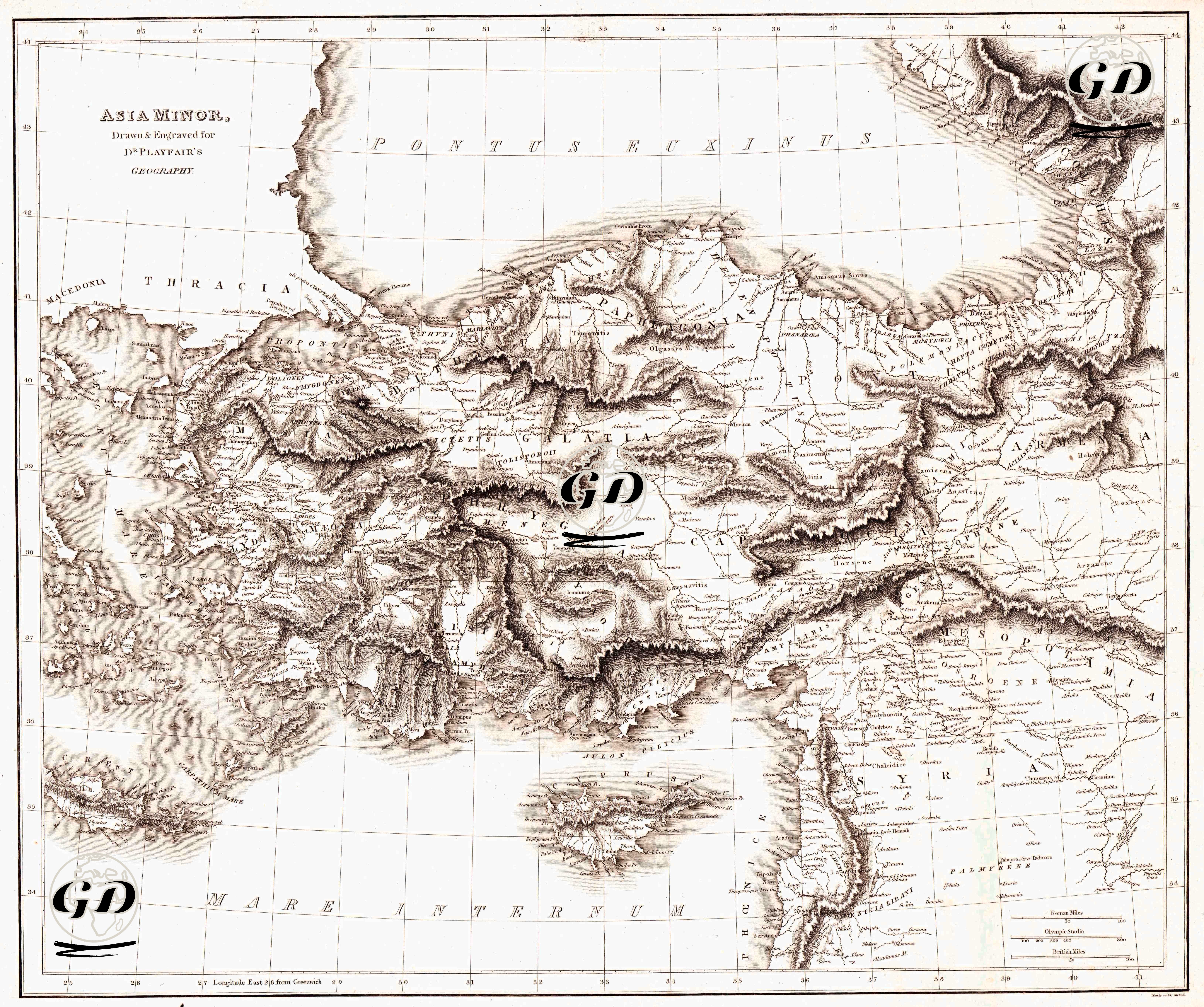
| Artist | James Playfair (1738-1819) |
| Engraver | Samuel John Neele (1758-1824) |
| Date | 1814 |
| Technique | Copper engraving |
| Category | Maps |
| Source | A New General Atlas, Ancient and Modern by James Playfair |
This engraving is a 54 × 46 cm map titled “Asia Minor,” prepared in 1814 by Samuel John Neele for Dr. Playfair’s Geography. It is part of an atlas series published by P. Hill and T. Underwood. The map covers much of present-day Turkey and the region extending south to Syria, with place names predominantly using Latin-classical terminology. Designations such as Pontus Euxinus (Black Sea) and Mare Internum (Mediterranean Sea) clearly demonstrate the map's claim to represent both ancient and modern geography. The topography is rendered using the hachure technique, characteristic of British atlas cartography of the time, creating a relief effect. Mountain ranges, valleys, and pass lines are highlighted with dense shading. The river network and coastlines are clarified with thin, controlled lines. The latitude and longitude grid and scale elements have transformed the map from a mere descriptive image into a measurable and instructive geographical tool. In the map, Anatolia is depicted not only as part of the contemporary Ottoman geography but also as the "historical stage" of the Greco-Roman legacy.