GRAVÜR DÜNYASI
Digital Engraving Library
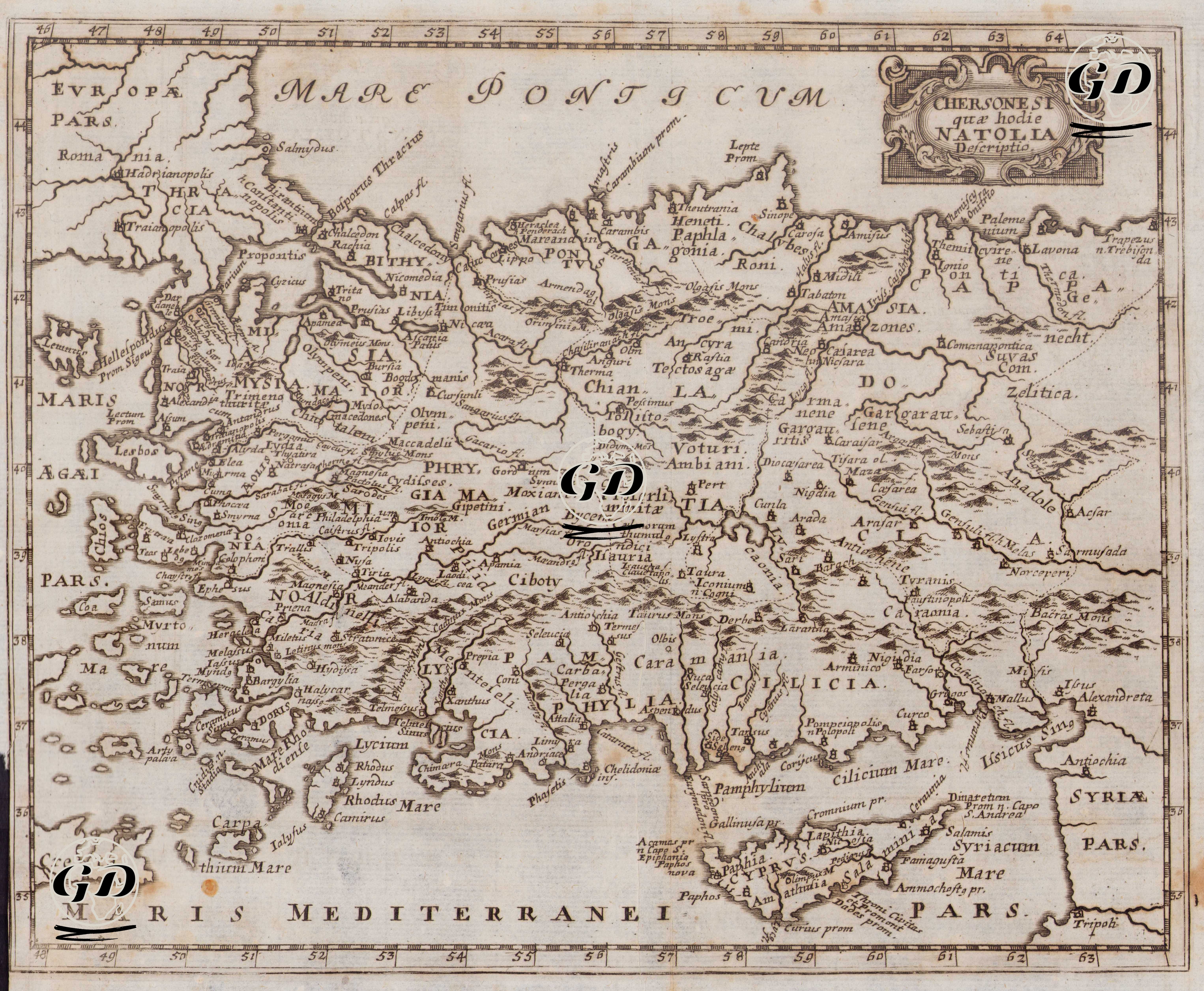
| Artist | Johannis Bunonis |
| Date | 1661 |
| Technique | Copper engraving |
| Category | Maps |
| Source | Cluver Introductionis in Universam Geograpicam by Johannis Bunonis |
This map is a depiction of the Anatolian Peninsula (Natolia) prepared by Johannis Bunonis and published in his 1661 work, Cluverii Introductionis in Universam Geographicam. The map, with its title “Chersonesi quae hodie Natolia Descriptio”, defines Anatolia as a “peninsula” (chersonesos) within the tradition of ancient geography and presents the region in detail using classical Roman-Greek place names. The systematic use of ancient provincial names such as Bithynia, Galatia, Cappadocia, Phrygia, Lycia, Cilicia, Pontus, and Paphlagonia reveals that the primary aim of the work was not to show the administrative structure of the contemporary Ottoman Empire, but rather to produce a historical geography consistent with ancient texts. This approach is a characteristic reflection of the classical school of geography, pioneered by Philipp Cluver, which had a great influence in early modern Europe. Mountain ranges are indicated by relief hatching, while rivers are shown with thin, continuous lines. Coastlines, islands, and seas (Mare Ponticum, Mare Mediterraneum, etc.) are clearly highlighted. While the density of settlements increases, especially in Western Anatolia and coastal regions, the interior is treated with a sparser and topography-centric approach. This demonstrates that the richness of information from ancient sources (Strabon, Pliny, Ptolemy) is directly reflected in the map. The map's coordinate system and margin measurements point to the increasingly standardized scientific measurement approach of 17th-century cartography, while the overall composition still balances philological accuracy with visual readability.