GRAVÜR DÜNYASI
Digital Engraving Library
| Date | 1877 |
| Technique | Woodblock Engraving (Newspaper-Text on Reverse) |
| Category | Uncategorized |
| Source | The Illustrated London News (May 12 1877-Page 450) |
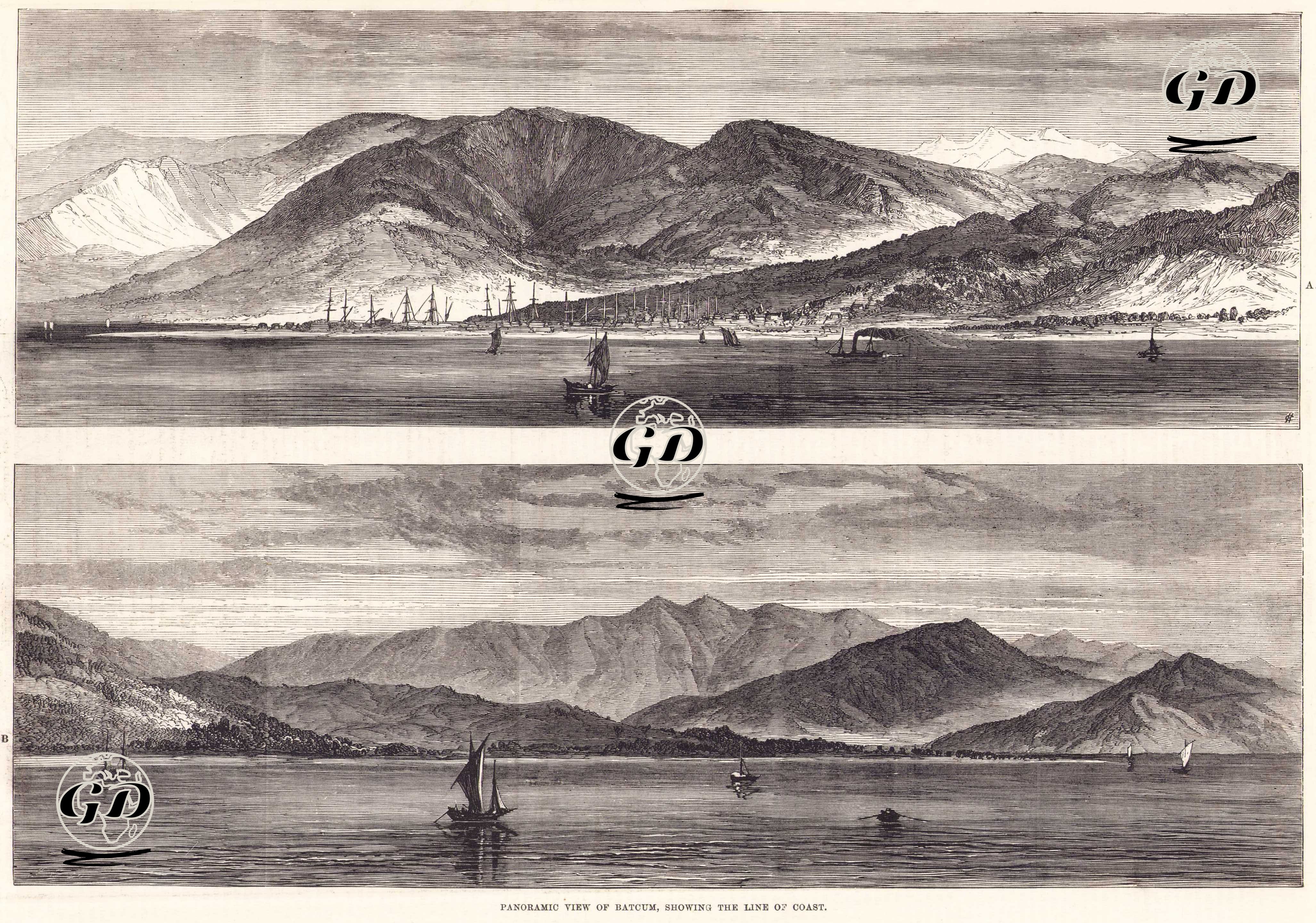
This two-part panoramic engraving, published in the May 12, 1877, issue of The Illustrated London News, depicts a panoramic view of the coastline and hinterland of Batumi (present-day Batumi/Georgia), one of the Ottoman Empire's most strategic ports during the Russo-Turkish War (1877-1878), located on the southeastern Black Sea. By the outbreak of the war in 1877, Batumi had become one of the Ottoman army's most important military bases on the Caucasus front. Consequently, the region's geography, port layout, and defensive capabilities were closely observed by Western observers. The upper image depicts the port of Batumi, nestled against the foothills of the mountains, in detail. The lower section offers a wider perspective further from the coast. These panoramic drawings were prepared to convey the military and geographical significance of the battlefield to British readers. In 1877, Batumi was considered the Ottoman navy's strongest base in the Black Sea, a supply point for the Caucasus front, and one of the ports most frequently targeted by the Russian army. The loss of Batumi risked the collapse of the Ottoman defenses in the Caucasus. Indeed, in 1878, following the Treaty of Berlin, the region was ceded to the Russians.